Project Version for Weather Stations, Solar PV Plants and Environmental Monitoring
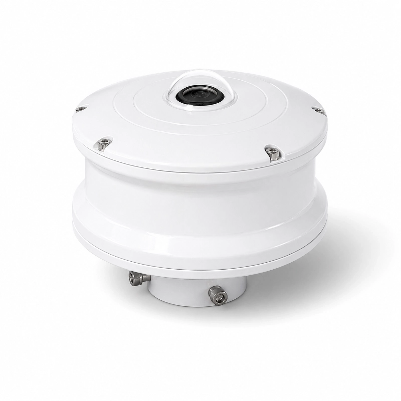
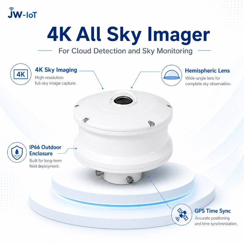
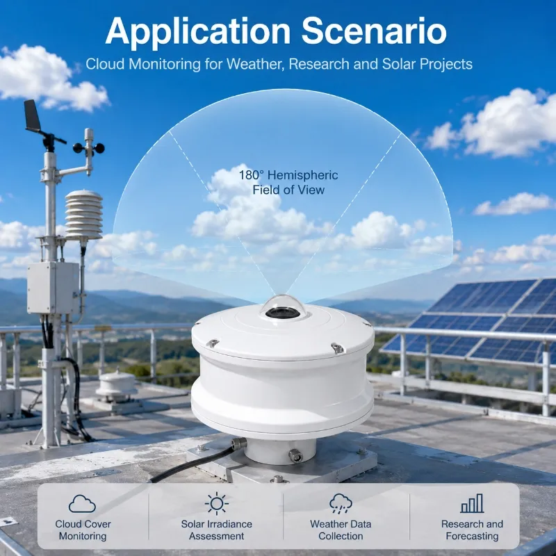
The JW-TK(LC12) 4K All Sky Imager is a project-ready ground-based sky imaging system developed for automatic cloud detection, cloud cover monitoring, cloud movement observation and solar power forecasting.
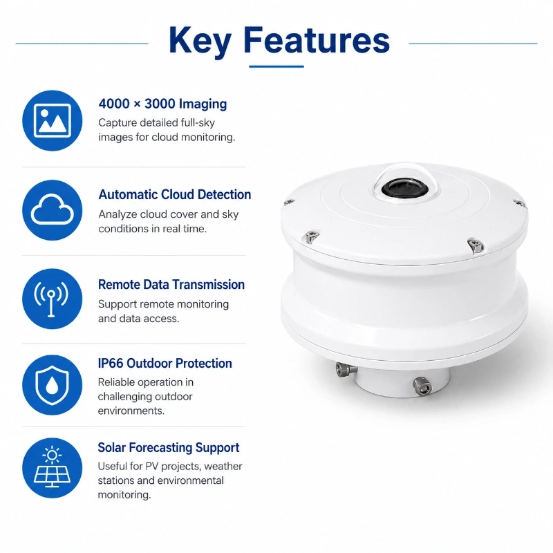
It captures high-resolution 4000 × 3000 pixel full-sky images through a hemispheric optical system and processes the images to identify cloud distribution and local sky conditions. Integrated GPS, outdoor protection, data storage and remote communication make the system suitable for permanent field deployment.
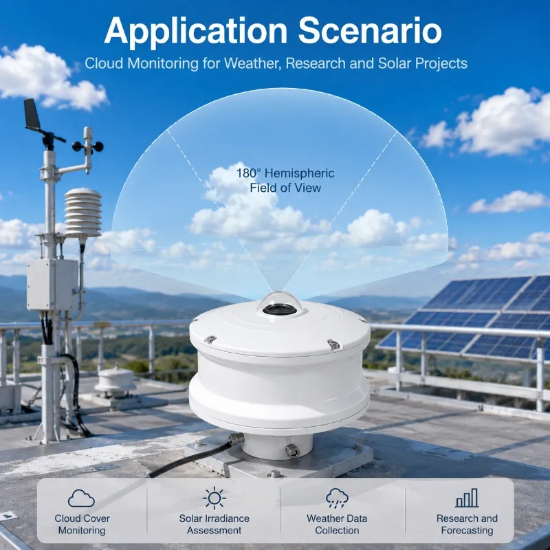
The project version is designed for solar PV plants, automatic weather stations, environmental monitoring networks, airports, universities, observatories and system integration projects that require stable sky imaging without building a complete camera and software system from the beginning.
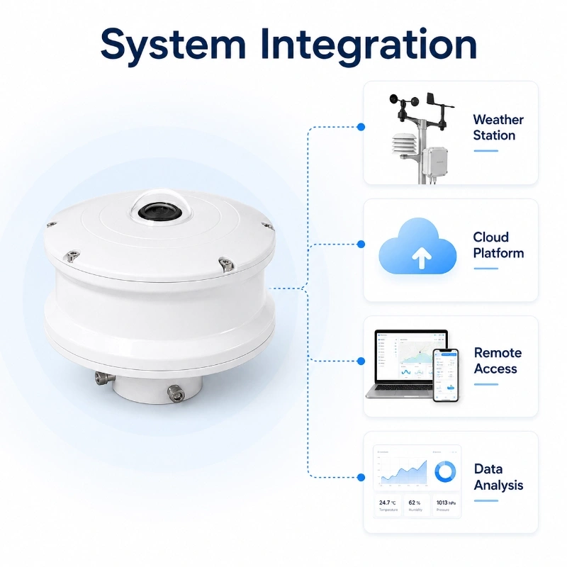
It can be supplied as a standalone all sky camera or integrated with a solar weather monitoring station, solar radiation sensors, data loggers and a remote monitoring platform.
Product Overview
The JW-TK(LC12) All Sky Imager combines a high-resolution image sensor, ultra-wide-angle optical lens, embedded processor, outdoor enclosure, GPS module, communication interface and cloud analysis software.
During operation, the system automatically captures images of the visible sky hemisphere at a configured interval. The internal software analyzes the images to distinguish cloud-covered areas from clear-sky areas and generates visual and numerical sky condition results.
The original image, processed image, cloud cover result, capture time, GPS information and device status can be stored locally or uploaded to a remote monitoring platform.
The system is intended for practical field projects where stable operation, standardized output, communication compatibility and outdoor reliability are more important than extensive algorithm modification.
What Can the All Sky Imager Monitor?
Depending on the selected software and project configuration, the system can provide:
Original full-sky image
Processed cloud detection image
Total cloud cover
Clear-sky percentage
Cloud-covered percentage
Cloud distribution
Cloud position
Local sky condition
Solar position
Capture date and time
GPS position
Equipment operating status
Historical image records
Historical cloud cover trends
Image sequence for cloud movement observation
Additional outputs may be available according to the final software version.
Please request the latest data output list before placing an order.
How the System Works
1. Full-Sky Image Acquisition
The hemispheric lens captures a wide view of the sky at a preset interval.
The image interval can be configured according to the application. Shorter intervals may be used for cloud movement or solar forecasting projects, while longer intervals may be selected for routine weather observation.
2. Image Processing
The system processes the original image according to the optical configuration and observation area.
Processing may include:
Valid sky area identification
Horizon masking
Image correction
Brightness adjustment
Solar-area treatment
Obstruction-area exclusion
Cloud and clear-sky segmentation
3. Cloud Detection
The cloud detection algorithm analyzes image brightness, color and visual features to distinguish cloud areas from clear-sky areas.
The system then calculates cloud cover and produces a processed cloud distribution image.
4. Data Storage
The following information can be stored locally:
Original images
Processed images
Cloud cover results
GPS information
Time stamps
System status
Historical records
Storage capacity and retention time depend on the image interval, image quality and selected storage configuration.
5. Remote Transmission
Images and analytical data can be transmitted to a local server or cloud platform through the selected communication method.
Project communication options may include:
Ethernet
RJ45
4G LTE
Wi-Fi
Local network
Customized data interface
The available communication method should be confirmed according to the final product configuration.
Project Version vs Research Version
JW-IoT provides different all sky imaging configurations for engineering projects and scientific research.
Comparison Item
Project Version
Research Version
Main purpose
Field deployment and system integration
Scientific research and algorithm analysis
Typical users
PV plants, EPC contractors, weather projects and system integrators
Universities, laboratories and research institutions
Solar radiation sensors measure irradiance at the monitoring site, while the all sky imager visually records the cloud conditions affecting irradiance.
Combining the two data sources can help users understand:
Why irradiance changed
Whether a reduction was caused by passing clouds
How cloud cover influenced PV output
When clear-sky conditions occurred
Whether cloud movement caused rapid power fluctuations
An all sky imager can help observatories record local sky conditions and support:
Observation scheduling
Cloud cover records
Sky condition archiving
Equipment protection decisions
Remote observatory management
Nighttime performance depends on the selected camera configuration and image processing software and should be confirmed before ordering.
All Sky Imager and Satellite Cloud Images
Ground-based all sky images and satellite images serve different purposes.
Ground-Based All Sky Imager
Observes local sky conditions from the monitoring site
Provides high-frequency images
Records small-scale cloud changes
Can be synchronized with local irradiance and weather data
Supports site-specific solar forecasting
Satellite Cloud Images
Cover large geographic areas
Show regional cloud movement
Support wide-area weather analysis
May have lower temporal or spatial relevance for a single PV site
For solar forecasting and local weather monitoring, ground-based sky images can complement satellite information.
System Integration
The JW-TK(LC12) can be supplied as an individual instrument or integrated into a complete monitoring solution.
A typical system may include:
4K All Sky Imager
Solar radiation sensor
Module temperature sensor
Ambient temperature and humidity sensor
Wind speed and direction sensor
Rain gauge
Data logger or industrial controller
Ethernet or 4G communication unit
Local or cloud server
Monitoring platform
API or database interface
Power supply and installation accessories
JW-IoT can support communication integration, sensor configuration, platform connection and remote technical support.
Communication and Data Management
Project communication can be configured according to site conditions.
Possible communication methods include:
Ethernet
RJ45
4G LTE
Wi-Fi
Local area network
Remote server upload
Customized API
The monitoring platform may provide:
Real-time sky image display
Cloud cover visualization
Historical image query
Historical data trends
Device status monitoring
GPS position display
Image download
Data export
User account management
Remote system diagnostics
Platform and API functions should be confirmed according to the final project requirements.
GPS Positioning and Time Synchronization
Accurate time stamps are important when sky images are compared with:
Solar irradiance data
PV power output
Weather station data
Satellite images
Numerical forecasting models
Multiple monitoring stations
The integrated GPS function can provide positioning and time information for project deployment.
The final GPS and time synchronization method should be confirmed in the project specification.
Outdoor Protection
The project version adopts an IP66 outdoor enclosure designed for permanent field installation.
It helps protect internal components against:
Outdoor dust
Rain
Wind-blown particles
General field weather exposure
IP66 protection does not eliminate the need for correct installation and maintenance.
The optical dome must remain clean and unobstructed to maintain image quality.
Installation Requirements
Open Sky View
Install the all sky imager where the visible sky is as unobstructed as possible.
Avoid locations close to:
Tall buildings
Trees
Towers
Chimneys
Overhead cables
Lighting poles
Reflective structures
Large antennas
Obstructions can reduce the valid sky area and affect cloud cover calculation.
Stable and Level Mounting
The device should be mounted on a stable horizontal structure.
The top optical lens must face upward, and the mounting base should remain level.
Correct Orientation
Record the installation orientation when directional cloud distribution or solar position is required.
The orientation should be consistent with the system software configuration.
Avoid Strong Reflection
Do not install the device directly beside highly reflective metal roofs, glass curtain walls or bright surfaces.
Strong reflections may interfere with image processing.
Power and Communication
Provide stable power and suitable communication according to:
Image capture interval
Transmission frequency
Local storage requirements
Network coverage
Remote access requirements
Site maintenance conditions
Optical Dome Maintenance
Regularly inspect and clean the optical surface.
Potential contamination includes:
Dust
Rain marks
Snow
Frost
Insects
Bird droppings
Salt spray
Industrial particles
Use a non-abrasive cleaning method suitable for the optical surface.
Factors Affecting Cloud Detection
Cloud detection performance can be influenced by:
Direct sunlight
Sunrise and sunset
Thin cirrus clouds
Haze
Fog
Dust
Rain droplets on the dome
Snow or frost
Strong reflections
Nearby obstructions
Artificial lighting
Nighttime conditions
For important forecasting projects, JW-IoT recommends evaluating the system under representative local weather and lighting conditions.
Software adjustment may be available after technical assessment.
Typical Technical Specifications
Parameter
JW-TK01 Local Version
JW-TK02 4G Version
Algorithm Version
JX1.3
SD1.1
Imaging Sensor Resolution
4K 12MP 4000 × 3000 pixels
4K 12MP 4000 × 3000 pixels
Focal Length
1.5 mm F2.0
1.5 mm F2.0
Field of View
Horizontal 210° Vertical 210° Diagonal 210°
Horizontal 210° Vertical 210° Diagonal 210°
Strong Light Suppression
Supported
Supported
Sun Shading Requirement
Not required
Not required
Fog Penetration
Supported
Supported
Image Enhancement
Supported
Supported
Backlight Compensation
Supported
Supported
3D Digital Noise Reduction
Supported
Supported
AI Super Noise Reduction
Supported
Supported
Automatic White Balance
Supported
Supported
Automatic Gain Control
Supported
Supported
Dynamic Contrast Enhancement
Supported
Supported
Wide Dynamic Range
120 dB
120 dB
Signal To Noise Ratio
≥50 dB
≥50 dB
Sampling Interval
60 s to 86400 s
60 s to 86400 s
Storage Capacity
256 GB
100 GB expandable
Web Data Platform
Supported
Supported
APP
Not supported
Not supported
Network Requirement
No internet required
4G network
Remote Algorithm Upgrade
Not supported
Not supported
Data Browsing Method
Local platform
Cloud platform
Data Output Format
RS485 Modbus excluding images
API JSON format
Main Control Box
Included
Not included
Operating Temperature
-40°C to 80°C
-40°C to 80°C
Operating Humidity
<95% RH no condensation
<95% RH no condensation
Protection Rating
IP66
IP66
Power Supply
DC12V / AC220V
DC12V / AC220V
Power Consumption
Max 20W Average 15W
Max 6W Average 3.6W
Cable Length
10 m standard
10 m standard
Technical specifications may vary according to the selected camera, storage, communication and software configuration. Request the latest datasheet before procurement.
Standard Project Configuration
A standard project package may include:
JW-TK(LC12) all sky imager
Outdoor mounting base
Power supply cable
Communication cable or wireless communication module
Local storage
Cloud detection software
Configuration documentation
Installation guide
Remote commissioning support
Optional accessories may include:
Solar power system
Industrial data logger
4G communication gateway
Ethernet communication module
Weather station sensors
Pyranometer
Module temperature sensor
Outdoor cabinet
Lightning and surge protection
Cloud monitoring platform
API integration
Customized mounting structure
The final delivery list should be confirmed in the quotation.
How to Select the Correct Configuration
Please provide the following project information:
Project application
Installation country and site
Number of monitoring points
Daytime or day-and-night monitoring requirement
Required image interval
Required cloud output parameters
Local storage period
Image transmission frequency
Available power supply
Available network connection
Required weather sensors
Cloud platform or API requirements
Local environmental conditions
Expected installation date
JW-IoT will recommend an appropriate camera, storage, communication and platform configuration.
Why Choose JW-IoT?
JW-IoT provides more than a standalone sky camera.
Our project support can include:
All sky imager configuration
Weather sensor integration
Solar radiation monitoring
Data logger and gateway configuration
Ethernet and 4G communication
Cloud platform connection
API integration
OEM and private-label service
Installation guidance
Remote commissioning
Long-term technical support
This allows system integrators, EPC contractors, energy companies and environmental monitoring partners to build a complete sensor-to-cloud monitoring solution.
Request a Quotation
To receive a quotation for the JW-TK(LC12) 4K All Sky Imager Project Version, please provide your application, installation location, required image interval, communication method, storage period, platform requirements and quantity.
1. What is the JW-TK(LC12) All Sky Imager used for?
A
It is used for automatic full-sky imaging, cloud detection, cloud cover monitoring, solar forecasting and weather station integration.
Q
2. What is the image resolution?
A
The project version captures sky images at a resolution of 4000 × 3000 pixels.
Q
3. Can the system calculate cloud cover automatically?
A
Yes. The image processing software can distinguish cloud-covered areas from clear-sky areas and calculate cloud cover within the valid observation area.
Q
4. Is the product suitable for outdoor installation?
A
Yes. The project version uses an IP66 outdoor enclosure. Correct installation and regular optical dome maintenance are still required.
Q
5. Does the all sky imager include GPS?
A
The project version supports GPS positioning and time information. The final GPS configuration should be confirmed in the project specification.
Q
6. Can it be used for solar PV power forecasting?
A
Yes. Full-sky images and cloud distribution data can support short-term solar irradiance and photovoltaic power forecasting when combined with local irradiance, weather and PV output data.
Q
7. Can the product connect to a weather station?
A
Yes. JW-IoT can integrate it with solar radiation, module temperature, wind, rainfall, temperature, humidity and atmospheric pressure sensors.
Q
8. Can images be transmitted through 4G?
A
A 4G communication configuration can be provided. Data traffic depends on image resolution, compression, capture interval and transmission frequency.
Q
9. What is the difference between the project version and research version?
A
The project version focuses on stable field deployment, standardized cloud monitoring and system integration. The research version is more suitable for original image datasets, algorithm development and scientific analysis.
 +86 13520127780
  info@jingelway.com