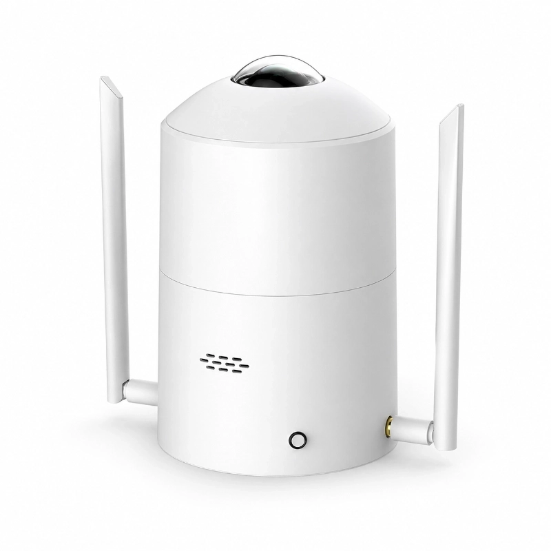
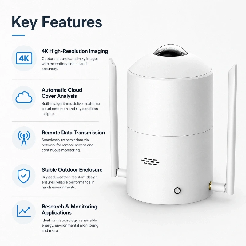
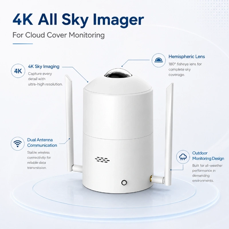
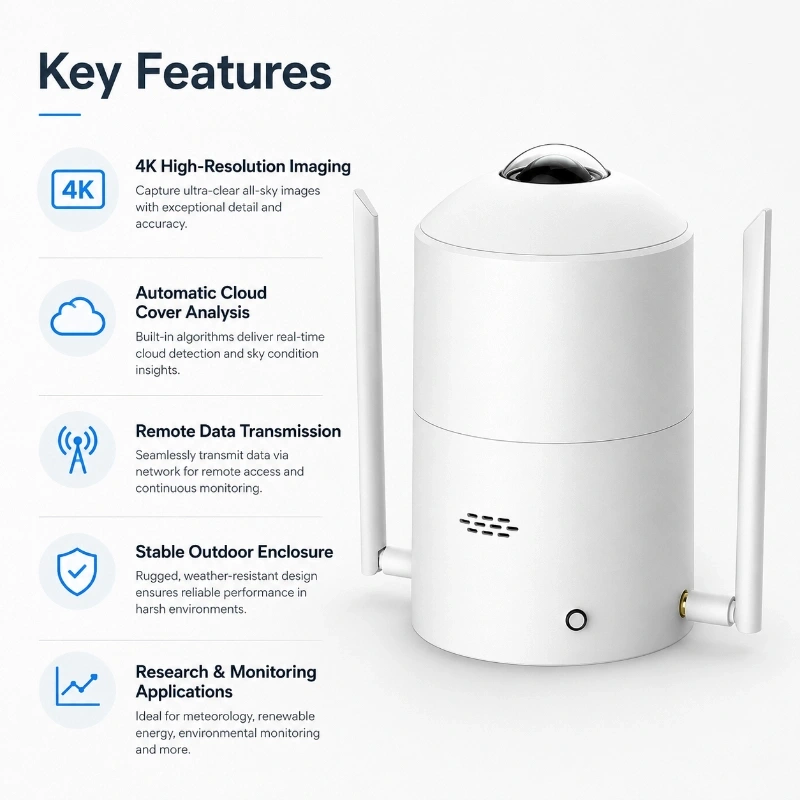
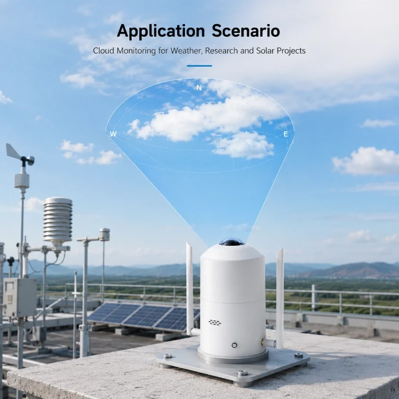
360 degree all sky imaging: Captures panoramic sky images for cloud cover monitoring, cloud movement analysis, and sky condition observation.
4K ultra high resolution camera: 12 megapixel imaging sensor with 4000 × 3000 pixel image output for clear sky and cloud recognition.
Optical sun glare suppression: Reduces direct sunlight interference and improves cloud layer visibility under strong solar radiation.
AI cloud amount analysis: Built in cloud recognition algorithm outputs real time cloud amount, cloud level, cloud type, and cloud movement data.
Automatic obstacle recognition: Deep learning algorithm automatically identifies and removes non sky objects from image analysis.
Supports local and internet versions: DC-TK01 supports 4G cloud connection, while DC-TK02 supports local deployment without internet access.
Flexible data output: Supports API JSON format, API, RS485, cloud platform, local server, Web platform, and APP access.
Long term data storage: Standard 100G storage supports at least 120 days of image and data storage, expandable by project needs.
Low power operation option: 4G version supports sleep and wake up functions for low power monitoring applications.
IP67 outdoor protection: Suitable for long term deployment in meteorological stations, solar energy fields, transportation projects, coastal sites, and research stations.
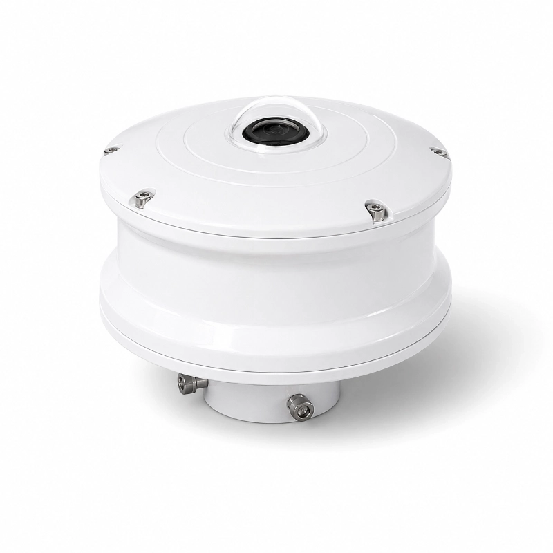
The JW-TK(LC7) 4K All Sky Imager is a professional ground-based sky imaging system developed for automatic cloud cover monitoring, hemispheric sky observation and sky condition analysis.
Using a high-resolution camera, wide-angle optical system and intelligent image analysis software, the system captures full-sky images and converts them into useful cloud and sky data. It can support meteorological research, solar energy assessment, environmental monitoring, weather observation, aviation studies and other research projects that require continuous visual information about the sky.
Unlike a standard outdoor surveillance camera, the JW-TK(LC7) is designed specifically for sky observation. It combines sky image acquisition, cloud recognition, cloud amount calculation, image storage, data analysis and remote communication in one integrated monitoring system.
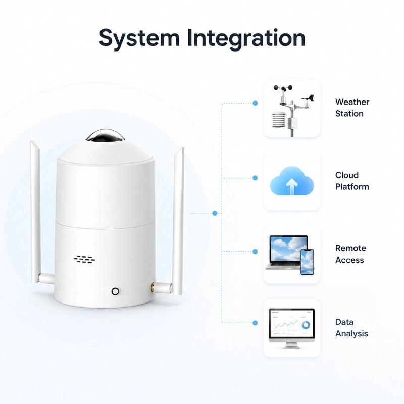
For projects that require additional weather parameters, the all sky imager can also be integrated with a weather monitoring station, solar radiation sensors and other environmental sensors.
What Is an All Sky Imager?
An all sky imager is a ground-based optical monitoring instrument that uses a fisheye or ultra-wide-angle lens to capture images of most or all of the visible sky hemisphere.
The captured images can be processed to distinguish clouds from clear-sky areas and calculate the percentage of the sky covered by clouds. Depending on the selected software configuration and project algorithm, the system can also provide cloud distribution, cloud movement, sunshine status, solar position and other sky-related analytical results.
Compared with manual cloud observation, an automatic all sky camera provides:
Continuous sky image acquisition
Repeatable cloud cover analysis
Digital records for later research
Higher observation frequency
Remote access to sky conditions
Easier integration with weather and solar monitoring systems
It provides localized, ground-based sky information that can complement weather station data, satellite observations and numerical weather models.
Product Overview
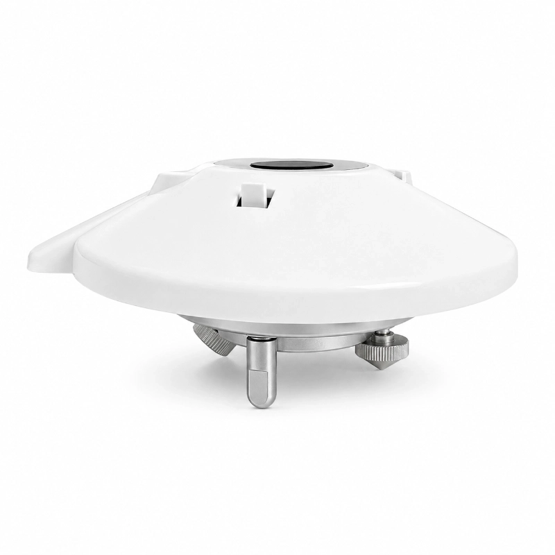
The JW-TK(LC7) All Sky Imager is designed to capture high-resolution sky images under outdoor operating conditions.
The system consists of a 4K imaging unit, hemispheric optical lens, protective enclosure, embedded processing unit, cloud analysis software, data storage module and communication interface.
During operation, the camera periodically captures sky images. The image processing software identifies cloud and clear-sky regions, calculates cloud-related parameters and stores both the original image and processed results.
The data can be viewed locally or transmitted to a remote platform, depending on the communication and software configuration selected for the project.
an be customized for research institutions, system integrators and OEM projects.
Main Functions
1. High-Resolution Full-Sky Imaging
The 4K imaging system records detailed hemispheric sky images for cloud observation and research.
High-resolution images make it easier to observe:
Cloud boundaries
Thin and thick cloud regions
Cloud distribution
Cloud movement
Clear-sky areas
Solar position
Changes in local sky conditions
The high-resolution image archive can also be used for algorithm development, model verification and long-term meteorological research.
2. Automatic Cloud Cover Monitoring
The system analyzes captured sky images and calculates cloud amount or cloud cover percentage.
It can help users identify:
Clear-sky conditions
Partly cloudy conditions
Overcast conditions
Changes in total cloud cover
Cloud distribution across the sky
Short-term changes in local cloud conditions
Cloud analysis results can be displayed together with the original sky image and processed cloud image.
3. More Than 30 Types of Sky and Cloud Data
Depending on the selected software version and project configuration, the All Sky Imager can output more than 30 types of sky and cloud analysis data, including:
Current system operating status
Real-time cloud amount
Cloud amount level
Total cloud cover
Cloud distribution
Cloud recognition results
Clear-sky area
Cloudy-sky area
Original sky image
Processed cloud image
Solar position
Sunshine status
Image capture time
Historical image records
Daily cloud condition changes
Additional analytical parameters may be configured according to the research objective, local sky conditions and project requirements.
Please contact JW-IoT for the complete output data list and software configuration available for the JW-TK(LC7).
4. Automatic Image Acquisition
The system can capture sky images automatically at a configured time interval.
The sampling interval can be selected according to the project purpose. For example:
Short intervals for cloud movement studies
Medium intervals for solar PV monitoring
Longer intervals for long-term climate observation
Event-based acquisition for special research projects
Image acquisition time, storage capacity and transmission frequency can be configured according to the communication bandwidth and data retention requirements.
5. Original and Processed Image Storage
The system can store:
Original 4K sky images
Cloud recognition images
Cloud segmentation results
Cloud cover data
System status information
Historical analysis records
This allows researchers and system operators to compare analytical results with the original images and verify the performance of the cloud recognition algorithm.
6. Remote Data Transmission
The All Sky Imager can be integrated into remote monitoring networks.
Depending on the project configuration, communication options may include:
Ethernet
4G LTE
Wi-Fi
Local network communication
Remote server connection
API or customized data interface
For remote sites, communication should be selected according to network coverage, image transmission frequency, file size and available power supply.
JW-IoT can help configure communication devices and data transmission methods for complete sensor-to-cloud monitoring systems.
7. Remote Monitoring and Data Management
Sky images and cloud analysis data can be accessed through a local computer, server or cloud-based monitoring platform, depending on the selected system architecture.
The platform can support functions such as:
Real-time sky image display
Cloud cover data display
Historical image query
Historical data query
Data export
Equipment status monitoring
Remote diagnostics
User account management
Alarm or abnormal status notification
Platform functions and data interfaces can be customized for research institutions, system integrators and OEM projects.
How Does the 4K All Sky Imager Work?
The monitoring process normally includes five steps.
Step 1: Sky Image Acquisition
The optical imaging unit captures a hemispheric image of the visible sky at a preset interval.
Step 2: Image Correction
The software processes the image according to the lens characteristics and installation configuration. Depending on the algorithm, correction may include image masking, horizon-area processing, brightness adjustment and geometric correction.
Step 3: Cloud Recognition
The image analysis algorithm distinguishes cloud regions from clear-sky regions using image color, brightness, texture and other visual characteristics.
Step 4: Cloud Cover Calculation
The system calculates the ratio of recognized cloud pixels to the valid sky observation area and generates cloud amount or cloud cover results.
Step 5: Data Storage and Transmission
Original images, processed images and analytical data are saved locally and can be transmitted to a remote server or cloud platform.
Because cloud recognition is influenced by sunlight, haze, precipitation, low visibility, lens contamination and local atmospheric conditions, project-specific algorithm adjustment may be recommended for research-grade applications.
Key Features
4K high-resolution sky imaging
Wide-angle hemispheric sky observation
Automatic cloud recognition
Real-time cloud amount calculation
Original and processed image output
More than 30 types of analytical data
Configurable image capture interval
Local image and data storage
Remote data transmission
Historical image and data query
Outdoor protective structure
Support for system integration
Custom software and data interface options
Suitable for research and professional monitoring projects
Research Version and Project Version
The JW-TK(LC7) is positioned as a research-oriented all sky imaging system.
The research version is suitable for users who require:
Access to original sky images
Cloud analysis results
Configurable observation intervals
Historical data archives
Algorithm evaluation
Data export
Integration with third-party research platforms
Customized cloud analysis functions
For standard engineering projects, JW-IoT can also recommend a suitable sky imager for cloud detection and sky monitoring according to the required functions, project budget and system architecture.
Please provide the required observation purpose before ordering so that the correct product version can be selected.
Main Applications
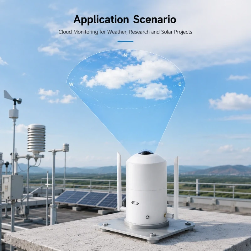
Meteorological Observation
The All Sky Imager can provide continuous visual records of local cloud and sky conditions.
It can be installed at:
Automatic weather stations
Meteorological research stations
Climate observation sites
University laboratories
Environmental monitoring stations
Remote field observation sites
When integrated with air temperature, humidity, atmospheric pressure, solar radiation, wind and rainfall sensors, it provides a more complete picture of local atmospheric conditions.
The system provides high-resolution sky images and cloud cover data for:
Cloud recognition algorithm development
Cloud segmentation research
Cloud classification studies
Cloud cover validation
Ground-based and satellite data comparison
Atmospheric optics research
Long-term cloud condition observation
Original images can be retained for independent analysis and model training.
Solar PV Monitoring and Forecasting
Cloud movement can cause rapid changes in solar irradiance and PV power output.
An all sky camera can support:
Local cloud observation
Cloud movement analysis
Short-term irradiance research
PV output fluctuation studies
Solar forecasting model development
Solar power plant performance analysis
Grid stability research
For a complete PV monitoring system, the sky imager can be combined with a solar irradiance sensor, module temperature sensor, ambient temperature and humidity sensor, wind sensor and data logger.
Cloud and sky conditions are important components of local environmental observation.
The system can support:
Urban environmental monitoring
Ecological observation
Atmospheric research
High-altitude field stations
Agricultural microclimate studies
Long-term environmental datasets
Aviation and Airport Weather Research
The All Sky Imager can provide visual cloud information for aviation meteorological research and airport weather observation projects.
Possible research applications include:
Local cloud cover records
Sky condition observation
Cloud development studies
Visibility-related research
Weather station data verification
The product is an environmental observation instrument and should not be used as the sole device for certified flight safety decisions unless it has been integrated into an approved aviation system.
The exact nighttime monitoring capability should be confirmed according to the selected camera, exposure configuration and cloud recognition algorithm.
Agriculture and Microclimate Research
Cloud cover affects solar radiation, crop photosynthesis, evapotranspiration and greenhouse energy balance.
The system can be used in agricultural research involving:
Crop microclimate observation
Solar radiation analysis
Evapotranspiration studies
Greenhouse environmental research
Precision irrigation research
Agricultural weather monitoring
Why Combine an All Sky Imager with a Weather Station?
An all sky camera provides visual cloud information, while a weather station measures physical environmental parameters.
A complete observation station may include:
All sky imager
Air temperature sensor
Relative humidity sensor
Atmospheric pressure sensor
Wind speed sensor
Wind direction sensor
Rain gauge
Solar radiation sensor
Pyranometer
Data logger
Communication gateway
Cloud platform
The sky image helps users understand what is happening above the monitoring site, while the weather sensors quantify the corresponding environmental conditions.
For example, a reduction in solar radiation can be compared with the sky image to determine whether the change was associated with passing clouds, complete overcast conditions or another environmental factor.
All Sky Imager vs. Standard Surveillance Camera
Item
JW-TK(LC7) All Sky Imager
Standard Surveillance Camera
Main purpose
Sky and cloud monitoring
Security monitoring
Field of view
Hemispheric or ultra-wide sky view
Limited directional view
Cloud analysis
Supported
Usually unavailable
Cloud cover calculation
Supported
Usually unavailable
Original sky image storage
Supported
Video-focused
Processed cloud image
Supported
Unavailable
Research data output
Supported
Limited
Weather system integration
Supported
Not designed for it
Configurable analytical software
Available
Usually unavailable
Long-term cloud datasets
Supported
Not a standard function
A standard IP camera may capture the sky, but it normally does not provide calibrated sky masks, cloud recognition, cloud cover calculation or research-oriented data output.
Ground-Based All Sky Imager vs. Satellite Cloud Images
Ground-based and satellite observations provide different perspectives.
A ground-based all sky imager provides:
Localized observation at the monitoring site
High-frequency sky images
Detailed visual information from below the cloud layer
Direct comparison with local weather and radiation sensors
Satellite imagery provides:
Wide regional coverage
Large-scale cloud movement information
Observation across extensive geographic areas
For research and forecasting projects, ground-based sky images can complement satellite products rather than replace them.
Installation Guidelines
Correct installation is important for reliable sky imaging and cloud analysis.
Select an Open Observation Location
Install the system where the sky view is as unobstructed as possible.
Avoid locations close to:
Tall buildings
Trees
Towers
Chimneys
Advertising boards
Overhead cables
Reflective walls
Strong artificial light sources
Permanent obstructions can reduce the valid sky observation area and affect cloud cover calculation.
Keep the Camera Level
The imaging unit should be installed vertically with the optical dome or lens facing the sky.
The mounting structure should remain stable under wind and outdoor vibration.
Record the Installation Orientation
The system orientation should be recorded during installation, especially when cloud direction, solar position or image coordinates are used in later analysis.
Reduce Reflection and Heat Interference
Avoid installing the unit directly above highly reflective roofs, metal surfaces or strong heat sources.
Reflected light and hot surfaces may affect image quality and the long-term operating environment of the instrument.
Provide Reliable Power and Communication
Select the power supply and communication method according to:
Image capture interval
Image transmission frequency
Network availability
Local power conditions
Required operating time
Remote site accessibility
Solar power can be considered for remote installations, but the complete power budget must include the camera, processor, heater or ventilation system, communication equipment and data logger.
Maintain the Optical Surface
Dust, rain marks, snow, insects and bird droppings can interfere with sky images.
The optical dome or protective window should be inspected and cleaned regularly using a suitable non-abrasive method.
Maintenance frequency depends on the local environment.
Factors That May Affect Cloud Recognition
Image-based cloud monitoring is influenced by field conditions.
Possible sources of uncertainty include:
Strong direct sunlight
Sunrise and sunset
Thin cirrus clouds
Haze and fog
Dust in the atmosphere
Rain or water droplets on the dome
Snow or frost
Lens contamination
Buildings or trees in the image
Nighttime illumination
Moonlight and artificial light
Local differences in cloud appearance
For research projects, JW-IoT recommends collecting representative local images and evaluating the recognition results under different weather and lighting conditions.
Project-specific software adjustment may improve performance for the local environment.
System Integration
The JW-TK(LC7) can be supplied as an individual instrument or as part of a complete monitoring system.
A complete project may include:
4K All Sky Imager
Weather and solar radiation sensors
Data acquisition unit
Local industrial computer
4G, Ethernet or Wi-Fi communication
Local or cloud server
Data visualization platform
API or database interface
Installation accessories
Remote technical support
JW-IoT can support OEM, ODM, private-label and project integration requirements.
Data Interface and Platform Integration
Before confirming the system configuration, please specify how the data will be used.
Possible integration requirements include:
Local image access
Remote image transmission
FTP or server upload
API data access
Database connection
Third-party cloud platform
Customized dashboard
Automatic data export
Original image download
Processed image download
Historical data synchronization
The available communication protocol and data format should be confirmed according to the final hardware and software version.
Technical Configuration
Because the JW-TK(LC7) is a research-oriented system, the final technical configuration may vary according to the selected camera, communication method, storage capacity and analytical software.
The project specification should confirm:
Configuration Item
Project Selection
Product model
JW-TK(LC7)
Imaging resolution
4K configuration
Observation type
Hemispheric sky imaging
Main output
Sky images and cloud analysis data
Capture interval
Configurable
Local storage
Configurable
Remote communication
Optional
Cloud platform
Optional
Data interface
Project-specific
Power supply
According to final configuration
Mounting accessories
Optional
Software functions
According to selected version
Custom development
Available after technical evaluation
Please request the latest datasheet before procurement. Technical parameters may vary according to the final project configuration.
How to Select the Correct All Sky Imager Configuration
Please consider the following questions before ordering:
Is the project for meteorology, solar PV, environmental research, aviation or astronomy?
Is daytime monitoring sufficient, or is nighttime monitoring also required?
What image capture interval is required?
Does the project require original 4K images?
Which cloud analysis parameters are required?
How long must images be stored locally?
Will all images be transmitted remotely?
Is Ethernet, 4G or Wi-Fi communication available?
Is a local server or cloud platform required?
Is an API or customized data interface required?
Will the system be integrated with a weather station?
What are the local temperature, rainfall, snow, dust and humidity conditions?
Providing this information allows JW-IoT to recommend a suitable hardware, software, storage and communication configuration.
Request a Quotation
To receive a suitable quotation for the JW-TK(LC7) 4K All Sky Imager, please provide:
Project application
Installation country and location
Daytime or day-and-night monitoring requirement
Required image interval
Required cloud analysis parameters
Local storage period
Communication method
Platform or API requirement
Required weather sensors
Quantity
Expected installation date
Our technical team will recommend the appropriate imaging, storage, communication and software configuration for your project.
1.What does the JW-TK(LC7) All Sky Imager measure?
A
The system captures hemispheric sky images and analyzes cloud and sky conditions. Depending on the software configuration, it can provide cloud amount, cloud cover, cloud distribution, original images, processed images and other analytical data.
Q
2. Is the product an all sky camera or a cloud sensor?
A
It is an image-based cloud monitoring instrument. It uses a wide-angle sky camera and image analysis software rather than measuring clouds with a single conventional weather sensor.
Q
3. Can the system calculate cloud cover automatically?
A
Yes. The software can identify cloud and clear-sky regions and calculate cloud amount or cloud cover within the valid observation area.
Q
4. Can JW-IoT provide original and processed images?
A
Yes. The system can be configured to store original sky images and cloud analysis images for research, verification and historical review.
Q
5. Can the All Sky Imager operate at night?
A
Nighttime performance depends on the selected imaging hardware, exposure settings, local light conditions and cloud recognition algorithm. Please state clearly whether day-and-night observation is required before quotation.
Q
6. Can the system be used for solar forecasting?
A
It can provide local sky images and cloud information for solar forecasting research and short-term irradiance analysis. A complete forecasting system may also require irradiance sensors, weather data and a forecasting algorithm.
Q
7.Can the camera transmit 4K images through 4G?
A
Yes, remote transmission can be configured, but the required data traffic depends on image size, capture interval, compression and storage strategy. For remote stations, it may be more efficient to transmit analytical results frequently and upload original images at a lower frequency.
Q
8. Can it be integrated with a weather station?
A
Yes. JW-IoT can integrate the All Sky Imager with weather, solar radiation and environmental sensors through a data logger, local server or cloud monitoring platform.
Q
9. Does JW-IoT support API and customized software?
A
API, platform integration and customized functions can be evaluated according to the project requirements. Please provide the required data format, server environment and interface description.
 +86 13520127780
  info@jingelway.com