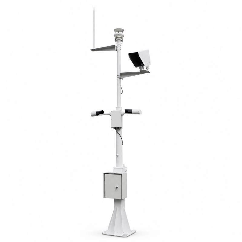
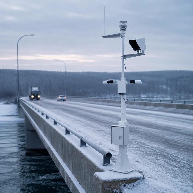
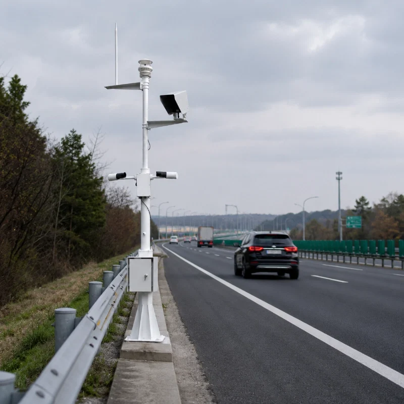
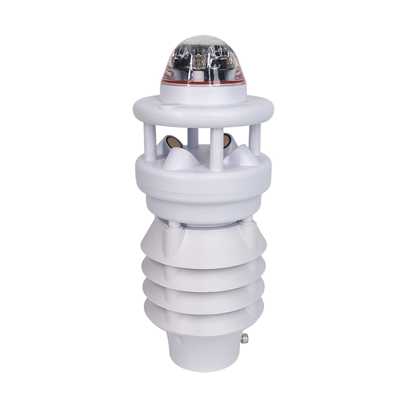
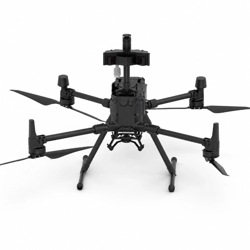
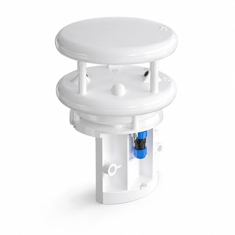
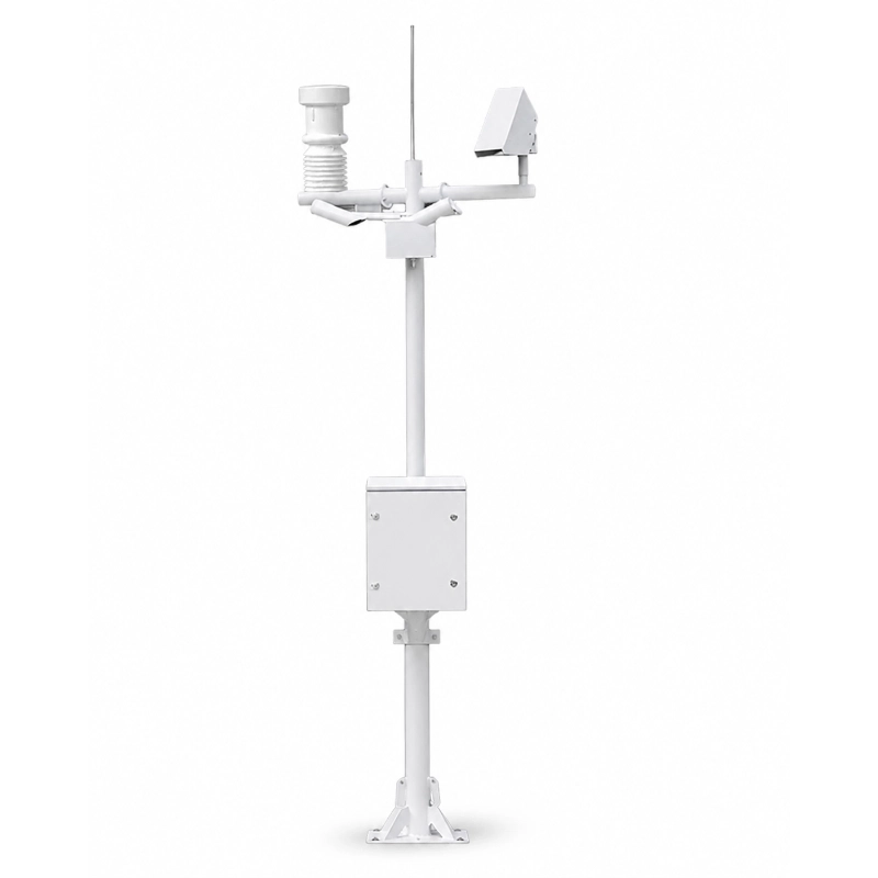
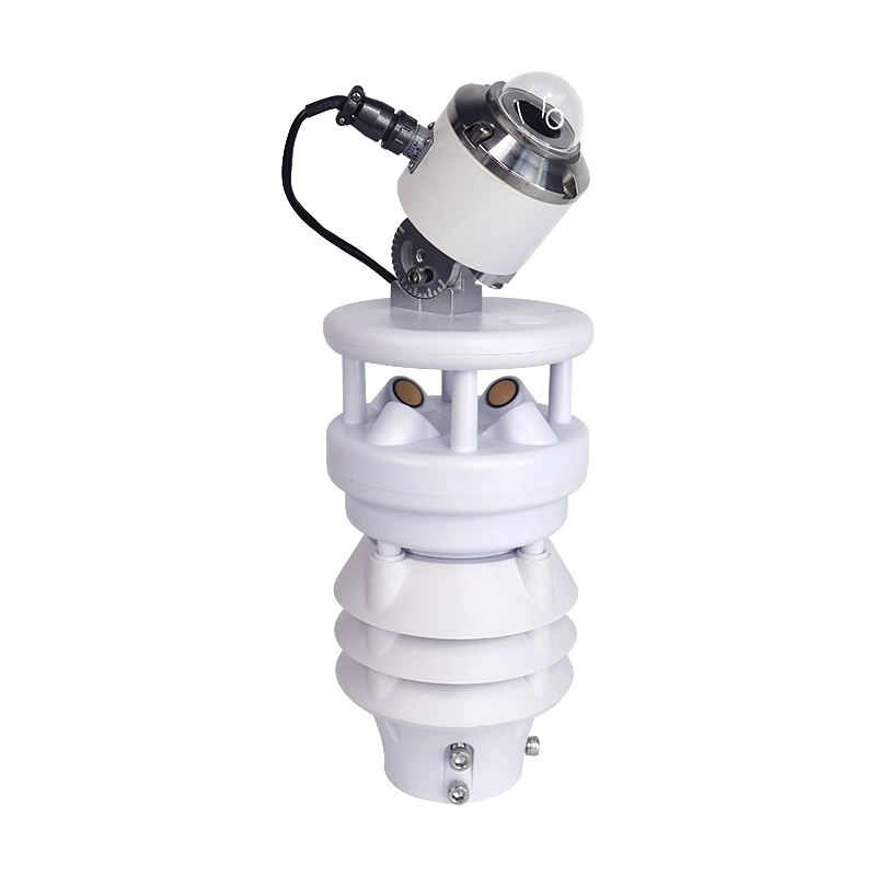
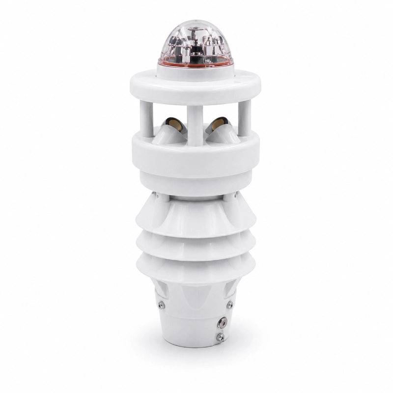
JW-TWS2(HY11) Road Weather Station is a fixed roadside environmental monitoring system designed for highways, expressways, bridges, tunnels, mountain roads and other traffic infrastructure.
It continuously collects local weather, visibility and road-surface data to help road authorities identify conditions that may increase the risk of:
Road icing
Wet or water-covered pavement
Snow accumulation
Low visibility
Strong crosswinds
Heavy rainfall
Fog and haze
Freezing conditions
Rapid pavement-temperature changes
The system can combine atmospheric sensors, non-contact road-surface sensors, visibility sensors, precipitation monitoring, cameras, a roadside data logger and remote communication equipment.
Data can be transmitted to a traffic management centre, highway maintenance platform, cloud dashboard or third-party Road Weather Information System for real-time display, historical analysis, alarm management and maintenance response.
What Is a Road Weather Station?
A road weather station is a roadside monitoring system that measures atmospheric and pavement conditions affecting traffic safety.
A general weather station mainly describes the surrounding atmosphere. A road weather station additionally focuses on the conditions experienced by vehicles and the road surface.
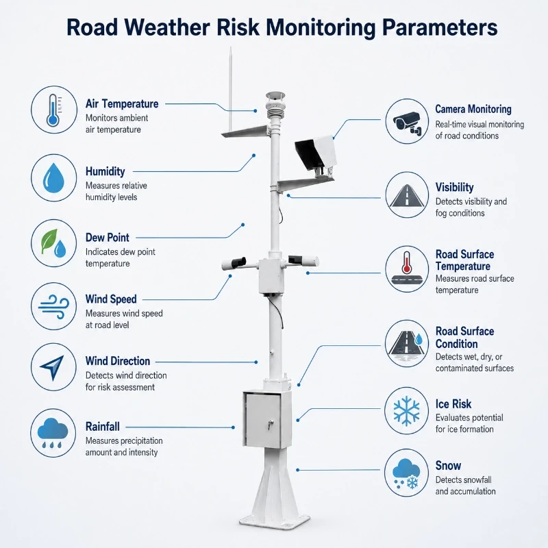
Typical measurements include:
Air temperature
Relative humidity
Dew point
Wind speed
Wind direction
Rainfall
Precipitation type
Visibility
Road surface temperature
Road surface condition
Water-film thickness
Snow depth
Camera images
This combination helps operators understand whether a road is likely to remain dry, become wet, freeze, accumulate snow or experience reduced visibility.
Why Highway Weather Monitoring Is Important
Weather conditions can change rapidly along a road corridor.
A regional weather forecast may not represent conditions at:
A bridge deck
A mountain pass
A shaded road section
A tunnel entrance
A tunnel exit
A river valley
A coastal highway
A high-altitude section
A fog-prone lowland
A historical icing location
Local monitoring provides information directly from the affected road section.
The data can support:
Winter road maintenance
De-icing decisions
Snow-removal planning
Speed-limit adjustment
Variable-message signs
Road-closure decisions
Driver warnings
Bridge crosswind warnings
Inspection scheduling
Post-storm assessment
Technical Parameters
Parameter
Specification
Product Model
JW-TWS2(HY11)
Product Type
Road Weather Station
Wind Speed Ultrasonic
0–60 m/s
Wind Direction Ultrasonic
0–359° no blind angle
Visibility Scatter Type
10–10000 m
Road Temperature
-40°C to +80°C
Road Condition
Dry, wet, snow, water, ice, ice-water mixture
Wetness Coefficient
0.00–0.82
Snow Depth
0.00–10.00 mm
Water Film Thickness
0.00–10.00 mm
Ice Thickness
0.00–10.00 mm
Ambient Temperature
-40°C to +80°C
Ambient Humidity
0–100% RH
Atmospheric Pressure
300–1100 hPa
Rainfall Radar
0–300 mm/h
Data Acquisition Module
HY-DMA2 intelligent acquisition module
Display and Operation
LCD display with touch keys
Communication
Multiple serial communication ports
Power Supply
AC power, DC power, or battery charging option
Deployment Mode
Standalone station or multi-station network
Road Weather Station vs General Weather Station
Monitoring Requirement
General Weather Station
Road Weather Station
Air temperature and humidity
Yes
Yes
Wind speed and direction
Yes
Yes
Rainfall
Yes
Yes
Road surface temperature
Usually not
Configurable
Dry, wet, snow and ice detection
No
Configurable
Water-film monitoring
No
Configurable
Road visibility monitoring
Optional
Common
Bridge and tunnel applications
General
Designed for road risks
Winter-maintenance support
Limited
Main application
Integration with traffic systems
Limited
Configurable
VMS and road-warning support
Limited
Supported through platform integration
Parameters That Can Be Monitored
The final configuration should be selected according to the project’s road type, climate and risk objectives.
Air Temperature
Air temperature provides the background condition for:
Freezing-risk assessment
Snow and sleet analysis
Frost conditions
Equipment compensation
Winter-maintenance planning
Air temperature alone does not confirm whether the road surface is frozen.
Relative Humidity
Humidity helps assess:
Condensation
Fog formation
Frost risk
Surface-moisture conditions
Atmospheric moisture before freezing
Dew Point
Dew point can help determine when surface condensation or frost may become more likely.
When the road-surface temperature approaches or falls below the dew point, moisture may condense or freeze depending on the thermal conditions.
Wind Speed and Wind Direction
Wind monitoring supports:
Bridge crosswind warnings
High-sided vehicle risk assessment
Snow drifting analysis
Fog movement interpretation
Precipitation exposure
Storm-response planning
For bridges and exposed mountain roads, wind gusts may be more operationally important than average wind speed.
Rainfall and Precipitation
Rainfall or precipitation sensors can support:
Rain-event detection
Rainfall intensity monitoring
Heavy-rain warning
Rain–snow transition assessment
Freezing-rain risk analysis
Drainage and flooding assessment
Maintenance scheduling
Visibility
Visibility may be reduced by:
Fog
Haze
Heavy rain
Snow
Blowing snow
Dust
Smoke
Spray from traffic
A visibility sensor can provide objective distance data for speed-control and warning systems.
Road Surface Temperature
Road-surface temperature is one of the most important parameters for winter road monitoring.
It may differ significantly from air temperature because of:
Solar heating
Night-time radiative cooling
Bridge-deck exposure
Surface material
Traffic
Shade
Wind
Stored ground heat
Road-surface temperature should therefore be measured directly or through a suitable non-contact pavement sensor.
Road Surface Condition
A road-surface sensor can identify or estimate conditions such as:
Water-film data can help distinguish light surface moisture from deeper standing water.
This can support:
Aquaplaning-risk assessment
Drainage evaluation
Winter freezing analysis
Rain-event response
Snow Depth
Snow-depth monitoring can support:
Snow-removal planning
Lane-closure decisions
Mountain-road management
Winter road reports
Maintenance verification
Camera Monitoring
A camera can provide visual confirmation of:
Snow cover
Fog
Rain
Traffic conditions
Road blockage
Maintenance activity
Flooding
Surface contamination
Camera data should complement sensor measurements rather than replace them.
How Road-Icing Risk Is Evaluated
Road icing should not be judged from air temperature alone.
A more reliable assessment may combine:
Road-surface temperature
Air temperature
Relative humidity
Dew point
Precipitation
Road-surface moisture
Water-film thickness
Road-surface status
Wind
Historical cooling trend
For example, a road may remain above freezing even when the air temperature briefly drops below 0°C. Conversely, a bridge surface may cool below freezing while nearby ground-level roads remain unfrozen.
The monitoring platform can combine several variables to generate a risk level, but final alarm logic should follow the road authority’s engineering criteria.
System Architecture
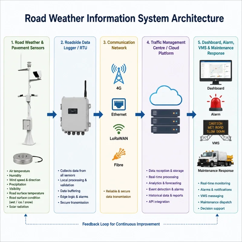
A typical Road Weather Information System architecture is:
Road Weather and Pavement Sensors
→ Roadside Data Logger or RTU
→ 4G / Ethernet / LoRaWAN / Fibre Network
→ Traffic Management Centre or Cloud Platform
→ Dashboard, Alarm, VMS and Maintenance Response
Field Monitoring Layer
The field layer may include:
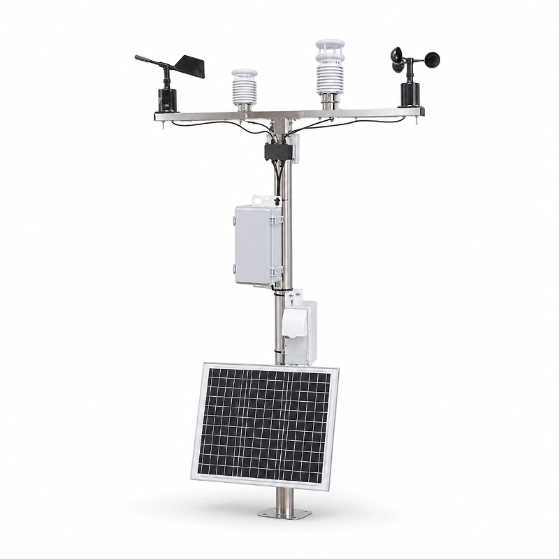
Automatic weather station
Road-surface condition sensor
Visibility sensor
Precipitation sensor
Snow-depth sensor
Camera
Water-level sensor
Roadside enclosure
Solar power system
Data-Acquisition Layer
The roadside controller can collect data through:
RS485 Modbus RTU
Analogue inputs
Pulse inputs
Digital inputs
Ethernet
Camera interfaces
Communication Layer
Available communication methods may include:
4G LTE
Ethernet
Fibre optic network
LoRaWAN
NB-IoT
Private traffic communication network
Satellite communication for selected remote roads
Platform Layer
The monitoring platform can provide:
Real-time road-weather data
Road-section map display
Historical trend curves
Ice and snow warnings
Visibility alarms
Crosswind alarms
Rainfall alarms
Sensor-fault alarms
Communication-loss alarms
Camera images
Maintenance records
Data export
API integration
Variable-message-sign integration
Typical Applications
Expressways and Highways
Road weather stations can be installed at high-risk sections to support:
Winter operations
Traffic management
Maintenance dispatch
Speed-limit decisions
Incident prevention
Driver information systems
Bridge Weather Monitoring
Bridge decks may cool differently from road sections supported by the ground.
Bridge monitoring may include:
Road-surface temperature
Air temperature
Humidity
Wind speed
Wind direction
Precipitation
Surface status
Camera
Strong crosswind and rapid bridge-deck cooling are common reasons to prioritize bridge monitoring points.
Tunnel Entrances and Exits
Tunnel portals can experience rapid changes in:
Visibility
Pavement temperature
Moisture
Wind
Fog
Snow
Ice
Sensors should be positioned so that the monitored section represents the actual portal risk rather than conditions deep inside the tunnel.
Mountain Roads
Mountain roads may face:
Sudden temperature changes
Fog
Snow
Icing
Strong wind
Avalanches
Landslides
Limited communication
Long emergency-response times
Recommended equipment may include pavement sensors, visibility sensors, snow-depth sensors and cameras.
High-Altitude Passes
High-altitude roads often require:
Low-temperature equipment
Solar-power design for winter
Snow and icing monitoring
Wind monitoring
Anti-condensation protection
Reliable remote communication
Reinforced mounting
Coastal Highways
Coastal roads may face:
Strong wind
Salt spray
Heavy rain
Fog
Corrosion
Storm surge
Reduced visibility
Corrosion-resistant mounting, connectors and enclosures should be selected.
Urban Elevated Roads
Elevated roads may require monitoring of:
Crosswind
Surface temperature
Rainfall
Visibility
Traffic-related spray
Local icing
Environmental noise
Fog-Prone Road Sections
Visibility sensors should be installed at locations with a history of:
Dense fog
Valley fog
Coastal fog
Smoke
Haze
Blowing snow
Monitoring-Point Selection
Monitoring points should be selected according to risk, not only by equal spacing.
Priority locations include:
Historical icing points
Bridges
Tunnel entrances and exits
Mountain passes
Shaded sections
River valleys
Fog-prone areas
High-wind sections
Sharp elevation changes
Flood-prone road sections
Snow-drift locations
Accident black spots
A long highway may require multiple stations because weather and pavement conditions can vary significantly between sections.
Installation Recommendations
Select a Representative Road Section
Install sensors where conditions represent the target risk.
Avoid locations where local heat, shade or drainage produces data unrelated to the monitored road section.
Avoid Wind Obstruction
Wind sensors should be positioned away from:
Signboards
Lighting poles
Buildings
Noise barriers
Trees
Bridge structures
Camera masts
that may cause turbulence or wind shadow.
Install the Road Sensor Correctly
For a non-contact road-surface sensor:
Maintain the specified mounting height;
Aim at a representative lane surface;
Avoid road markings where possible;
Avoid areas frequently covered by stationary vehicles;
Keep the optical path clear;
Prevent the bracket from moving.
Position the Visibility Sensor Carefully
Avoid:
Direct sunrise or sunset glare
Headlight glare
Exhaust plumes
Water spray
Permanent traffic obstruction
Nearby reflective surfaces
Protect the Camera Field of View
The camera should clearly show:
The monitored lanes
Road shoulder
Surface condition
Relevant visibility conditions
Avoid strong backlighting and structural obstruction.
Protect the Roadside Cabinet
The enclosure should include:
Waterproof cable glands
Surge protection
Grounding
Lightning protection
Ventilation or thermal control
Battery protection
Secure locks
Anti-vandal design where required
Evaluate Solar Power
Solar-system sizing should consider:
Sensor power consumption
Camera power
Transmission frequency
Heater use
Winter sunlight
Consecutive cloudy days
Battery ageing
Low-temperature battery performance
Snow covering the panel
Communication Options
4G LTE
Suitable for dispersed roadside stations where cellular coverage is available.
Ethernet or Fibre
Suitable for highways with existing intelligent-transport communication infrastructure.
LoRaWAN
Suitable when several sensors are deployed within gateway coverage and data volume is relatively low.
Alarm and Response
Possible alarms include:
Road-surface temperature approaching freezing
Ice or snow detected
Wet pavement under freezing conditions
Water-film threshold exceeded
Visibility below threshold
High wind or crosswind
Heavy rainfall
Snow-depth threshold exceeded
Communication failure
Sensor fault
Low battery
Cabinet intrusion
Alarm thresholds should be configured according to:
Local climate
Road geometry
Bridge design
Vehicle type
Speed limit
Historical incidents
Maintenance capability
Road authority procedures
Road Weather Station vs Standalone Road Sensor
Requirement
Complete Road Weather Station
Standalone Road Sensor
Air weather data
Yes
Usually no
Road surface temperature
Configurable
Yes
Surface-condition detection
Configurable
Yes
Wind monitoring
Yes
No
Visibility monitoring
Configurable
No
Precipitation monitoring
Yes
Limited
Remote platform
Integrated
Requires controller
Multi-parameter alarms
Yes
Limited
Best for complete RWIS point
Yes
Supporting sensor
Request a Road Weather Station Configuration
Send JW-IoT your highway location, road type, historical weather risks, required sensors, communication coverage and platform requirements.
Our team will help configure a suitable road weather station, pavement monitoring sensors, roadside communication equipment and remote warning platform.
1. What is JW-TWS2(HY11) road weather station used for?
A
It is used for highway traffic weather monitoring, road surface condition detection, icing warning, rainfall monitoring, visibility monitoring, and intelligent transportation safety management.
Q
2. What road surface conditions can this station detect?
A
It can detect dry road, wet road, snow, water, ice, and ice-water mixed conditions. It can also monitor road temperature, wetness coefficient, snow depth, water film thickness, and ice thickness.
Q
3. Does the road surface sensor require road cutting?
A
No. It supports non-invasive road condition monitoring, helping reduce installation complexity and road construction impact.
Q
4. Can JW-IoT integrate this road weather station with a traffic monitoring platform?
A
Yes. JW-IoT can integrate the HY-TWS2 with traffic command platforms, road weather information systems, and intelligent transportation monitoring networks.
Q
5. What meteorological parameters can the station monitor?
A
It can monitor wind speed, wind direction, visibility, ambient temperature, humidity, atmospheric pressure, rainfall intensity, and road surface condition parameters.
Q
6. Is JW-TWS2(HY11) suitable for unattended operation?
A
Yes. The station is designed for long-term unattended operation in harsh outdoor environments and can be deployed on highways, bridges, tunnels, and mountain roads.
Q
7. Can JW-IoT customize the sensor configuration?
A
Yes. JW-IoT can customize the road weather station configuration according to project requirements, including visibility, rainfall, road surface condition, wind, temperature, humidity, pressure, and communication modules.
Q
8. What power supply options are available?
A
The system can support AC power, DC power, and battery charging options to ensure continuous operation during power interruptions.
Q
9. Can JW-IoT provide a multi-station road weather monitoring solution?
A
Yes. JW-IoT can provide standalone stations or multi-site road weather monitoring networks for highway safety, traffic management, and road maintenance projects.
 +86 13520127780
  info@jingelway.com