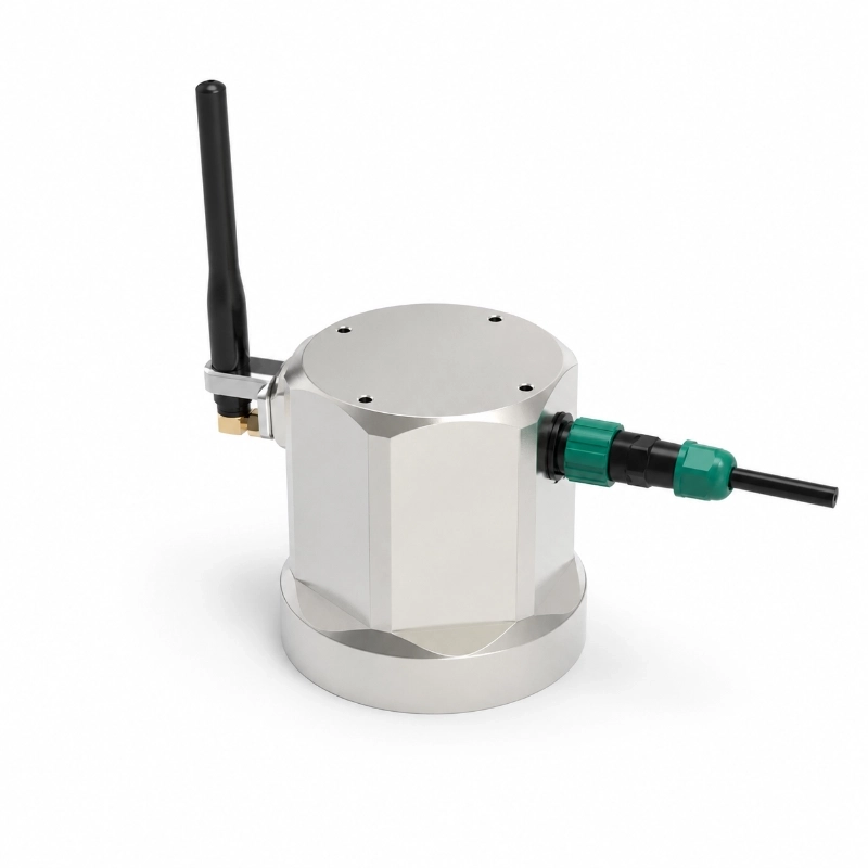
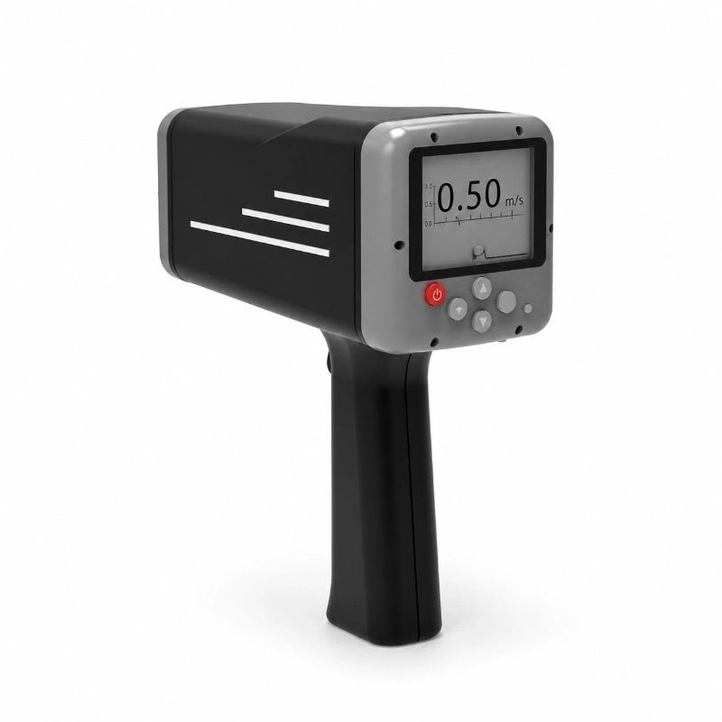
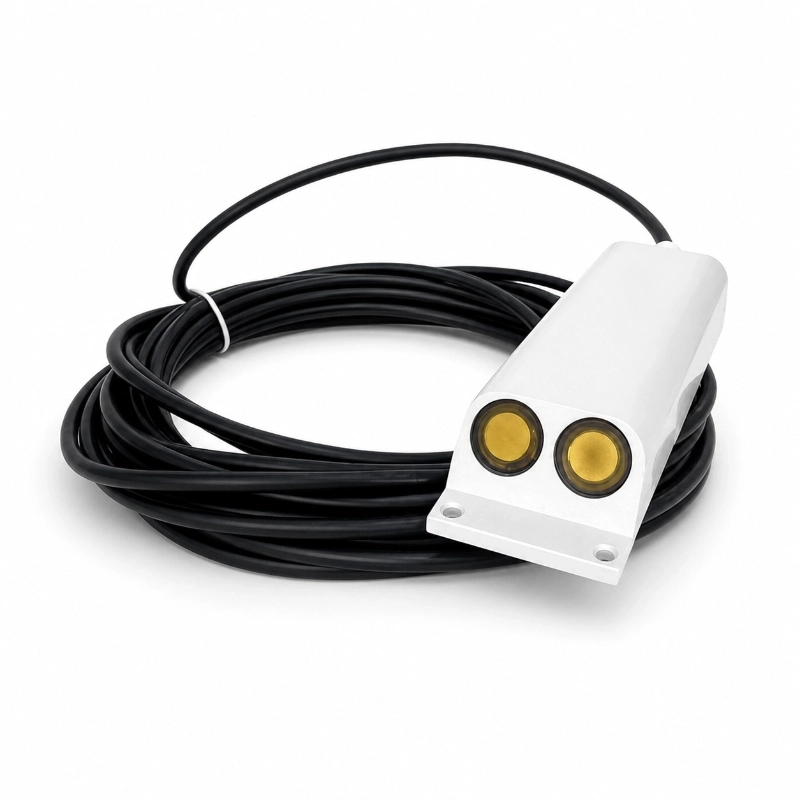
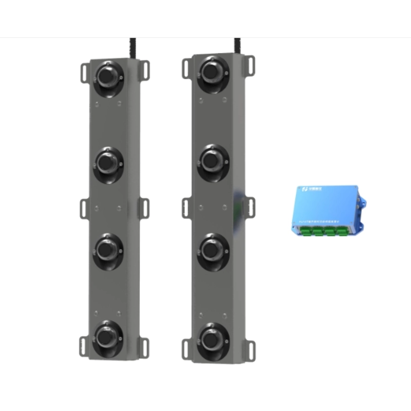
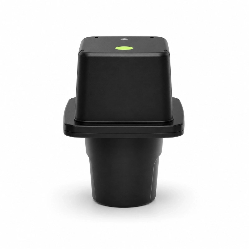
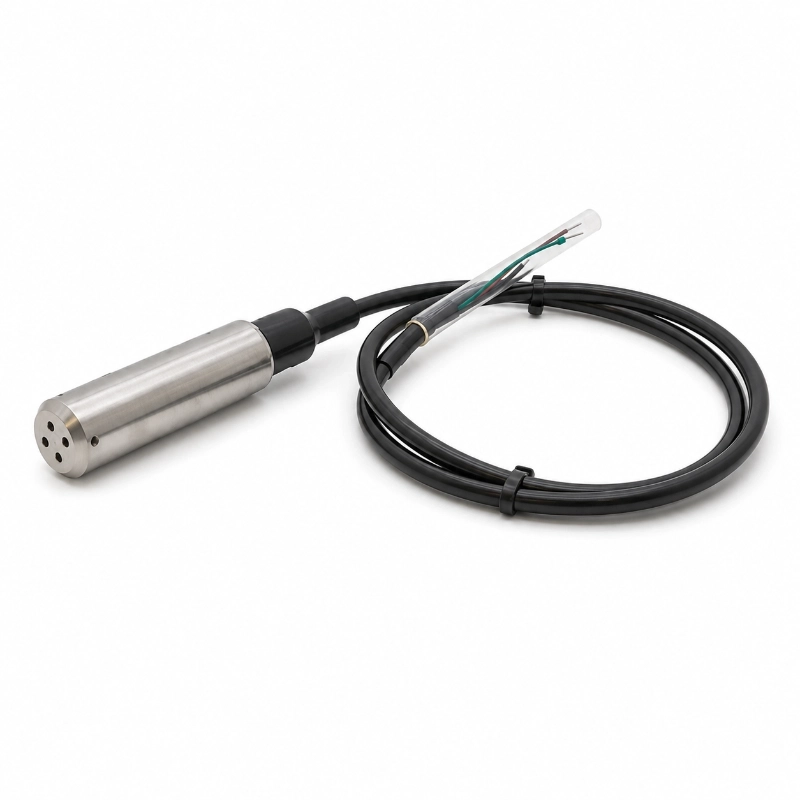
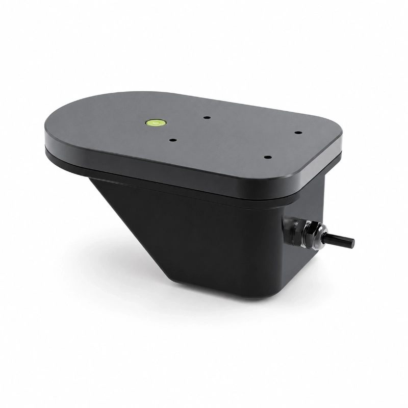
The JW-RD-300R(HJ02) Integrated Radar Water Level Gauge is a non-contact FMCW radar water level sensor designed for hydrological stations, river level monitoring, reservoir management, flood warning, and remote water resource monitoring.
Using 24 GHz or 80 GHz radar technology, the device measures the distance between its antenna and the water surface without physical contact. Available measurement ranges include 15 m, 40 m, 70 m, and 110 m, depending on the selected configuration.
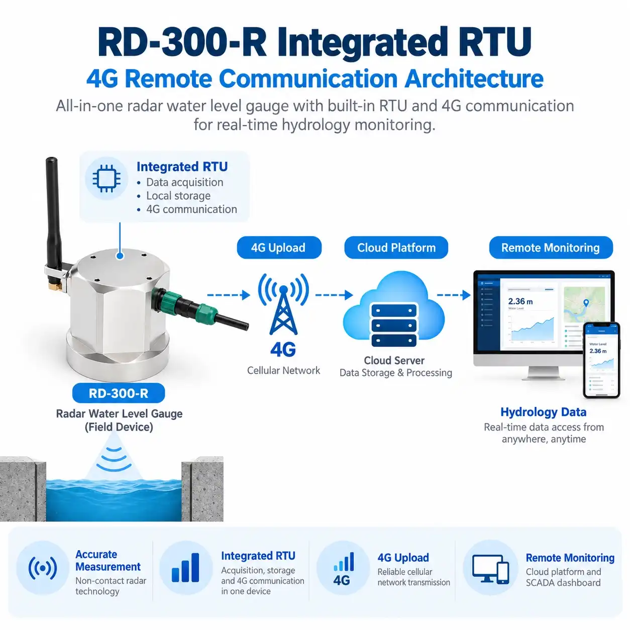
For remote monitoring stations, the RD-300-R version integrates an RTU with wireless data transmission options, allowing water level information to be uploaded to compatible monitoring platforms without a separate external telemetry terminal.
With IP68 protection, Bluetooth configuration, a wide DC power input, and solar power compatibility, the device is particularly suited to unattended water level monitoring stations.
1. What Is an Integrated Radar Water Level Gauge?
An integrated radar water level gauge is an instrument that measures the distance from a fixed mounting position to the surface of a river, reservoir, lake, or channel.
Unlike submerged pressure sensors, a radar level gauge is normally installed above the water surface.
The JW-RD-300 series uses frequency-modulated continuous wave (FMCW) radar technology to obtain a distance measurement.
When the instrument’s installation elevation or reference datum is known, measured distance can be converted into water surface elevation or level relative to a defined reference.
For hydrological applications, this provides a continuous record of water level changes.
RD-300 vs RD-300-R
The product family includes two configurations.
RD-300: Radar water level measurement with wired communication for integration into an existing hydrological monitoring station.
RD-300-R: Radar water level monitoring with an integrated RTU for remote data upload, subject to the selected communication module and configuration.
The integrated RTU option is particularly relevant when project operators want to reduce the number of separately installed communication devices.
2. How Does FMCW Radar Measure River Water Level?
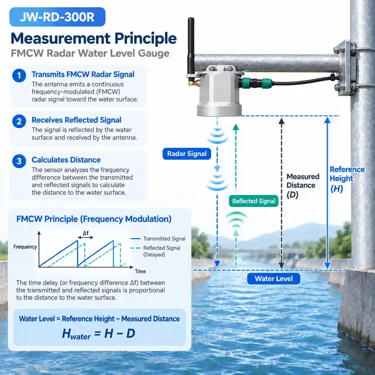
FMCW radar transmits a frequency-modulated radar signal toward the water surface.
Part of the signal is reflected back to the receiving antenna. The instrument processes the difference between transmitted and received signals to determine the distance to the reflecting surface.
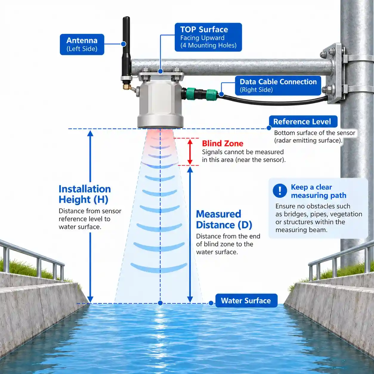
For an overhead installation:
Water Level = Reference Height − Measured Radar Distance
The reference height must be established using the project’s chosen measurement datum.
For example, if the reference height is 10 m and the measured distance is 6 m, the calculated level relative to that reference is 4 m.
This example illustrates the calculation only and does not represent an actual measurement.
Advantages of Non-Contact Measurement
No direct water contact
The sensor can operate above sediment-laden or polluted water without placing its sensing element in the flow.
Reduced exposure to debris
Floating debris and floodwater do not normally contact the elevated sensor when it is installed above the maximum expected water level.
Suitable for changing river conditions
The technology supports continuous water surface monitoring under various flow conditions.
Flexible mounting
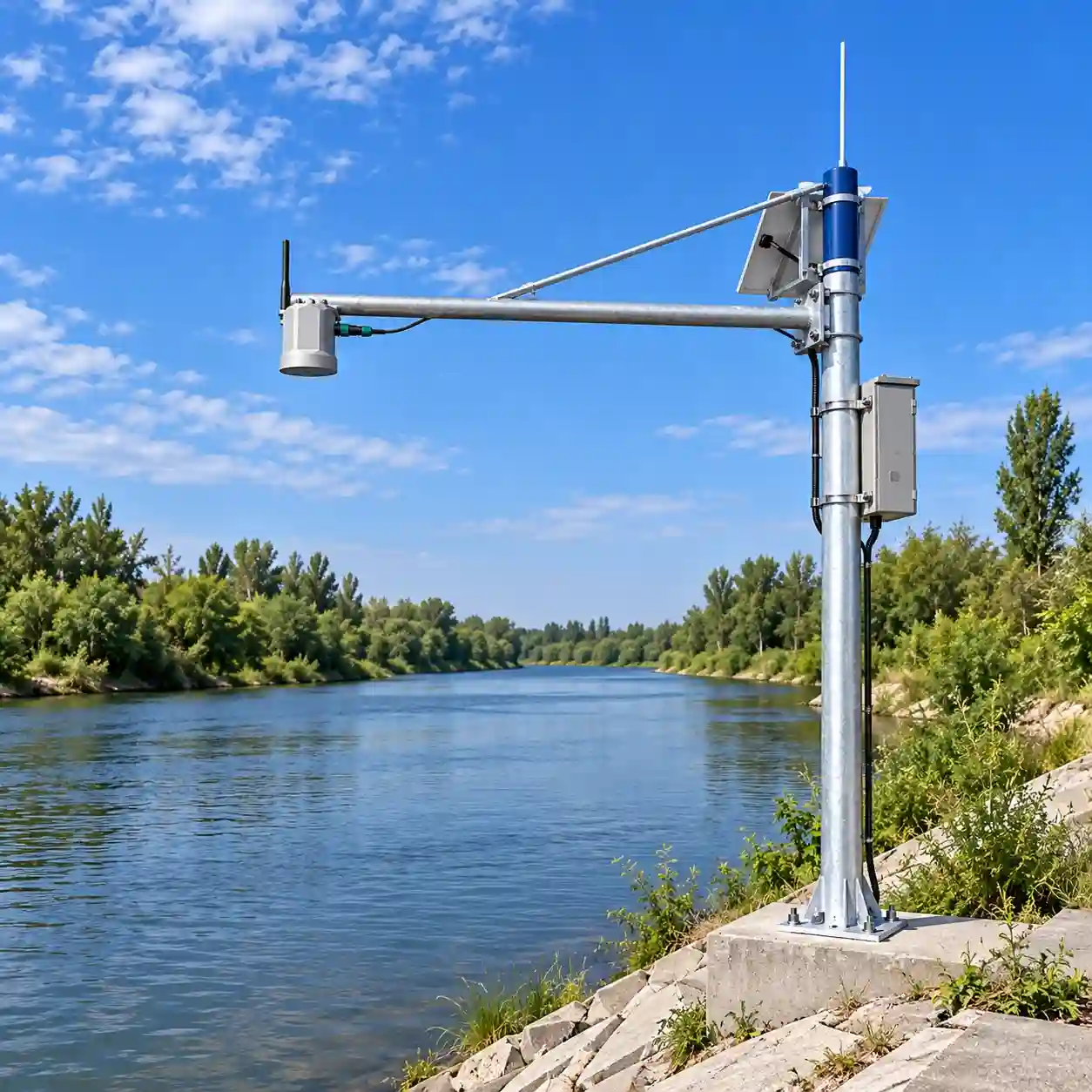
Depending on the installation structure, the gauge may be mounted on bridges, brackets, riverbank poles, or dedicated hydrological monitoring structures.
Radar performance still depends on installation geometry, surface conditions, obstructions, antenna configuration, and proper commissioning.
3. Technical Specifications
Parameter
Specification
Product Type
Integrated Radar Water Level Gauge
Product Model
JW-RD-300R(HJ02)
Series
RD-300 / RD-300-R
Measurement Principle
FMCW Radar
Radar Frequency
24 GHz or 80 GHz
Measuring Range
15 / 40 / 70 / 110 m
Accuracy
±3 mm / ±0.05% FS
Resolution
1 mm
Default Blind Zone
20 cm
Beam Angle
11° / 8°
Antenna
Flat Microstrip Array
Standard Interface
RS485
Optional Interfaces
RS232 / SDI-12
Analog Output
4–20 mA Optional
Wired Protocol
Modbus
Bluetooth
Bluetooth 4.2 or Above
Wireless Options
4G / NB-IoT / LoRa
Upload Protocols
SL651 / SZY206 / MQTT / Customized
RTU Upload Interval
5 Minutes to 24 Hours
Working Voltage
7–32 VDC
Operating Temperature
-35°C to +70°C
Storage Temperature
-40°C to +70°C
Protection Rating
IP68
Lightning Protection
6 kV
Housing Options
UV-Resistant ASA / Aluminum Alloy
Configuration notice: Measuring range, radar frequency, beam angle, communication interfaces, and wireless functions vary by product version. The specifications listed above describe available configurations and should not be interpreted as one universal configuration.
4. Integrated RTU for Remote Hydrological Stations
Traditional hydrological monitoring systems may require a separate water level sensor, RTU, and communication module.
The RD-300-R integrates water level measurement with telemetry functions, reducing the need for a separate external RTU in suitable projects.
Remote Monitoring Architecture
Integrated Radar Water Level Gauge → 4G / NB-IoT / LoRa Network → Remote Server → Hydrological Monitoring Platform
Depending on the communication configuration, the integrated RTU can upload water level measurements through compatible communication protocols.
Available Communication Options
4G Cellular Communication
Suitable for monitoring sites with compatible cellular network coverage.
NB-IoT
An option for installations using supported narrowband cellular infrastructure.
LoRa
An option for projects with compatible local wireless communication infrastructure. The exact radio implementation and gateway compatibility must be confirmed.
Hydrological Data Protocols
The product page lists support for SL651, SZY206, MQTT, HJ212, HTTP, and customized communication options.
Protocol availability and implementation should be confirmed for the selected firmware and monitoring platform.
The RD-300-R supports configurable data upload intervals from 5 minutes to 24 hours.
Actual transmission success depends on network availability, platform configuration, and the selected upload settings.
5. Applications in Hydrological Monitoring
5.1 River Water Level Monitoring
River hydrological stations collect water level information to understand changes in river stage over time.
The JW-RD-300 series can be mounted above the river surface and integrated into an existing telemetry network or configured as a remote monitoring device.
Typical applications include river stage observation, upstream/downstream level comparison, and multi-station river monitoring.
Fast-rising river levels are an important input for flood warning systems.
Radar measurement allows water level monitoring without placing equipment directly in floodwater.
When combined with rain gauges, telemetry, configured thresholds, and external warning equipment, water level data can support flood risk monitoring and emergency response.
The radar gauge is a measurement component rather than a complete standalone public warning system.
Explore the JW-IoT Flood Monitoring System for an integrated water level, rainfall, communication, and alarm architecture.
5.3 Reservoir and Lake Level Monitoring
Reservoirs and lakes require continuous water surface monitoring for operational records and water resource management.
An overhead radar gauge can provide remote water level measurements when installed with an appropriate reference datum.
The instrument can be integrated into reservoir monitoring platforms through wired interfaces or an optional integrated RTU.
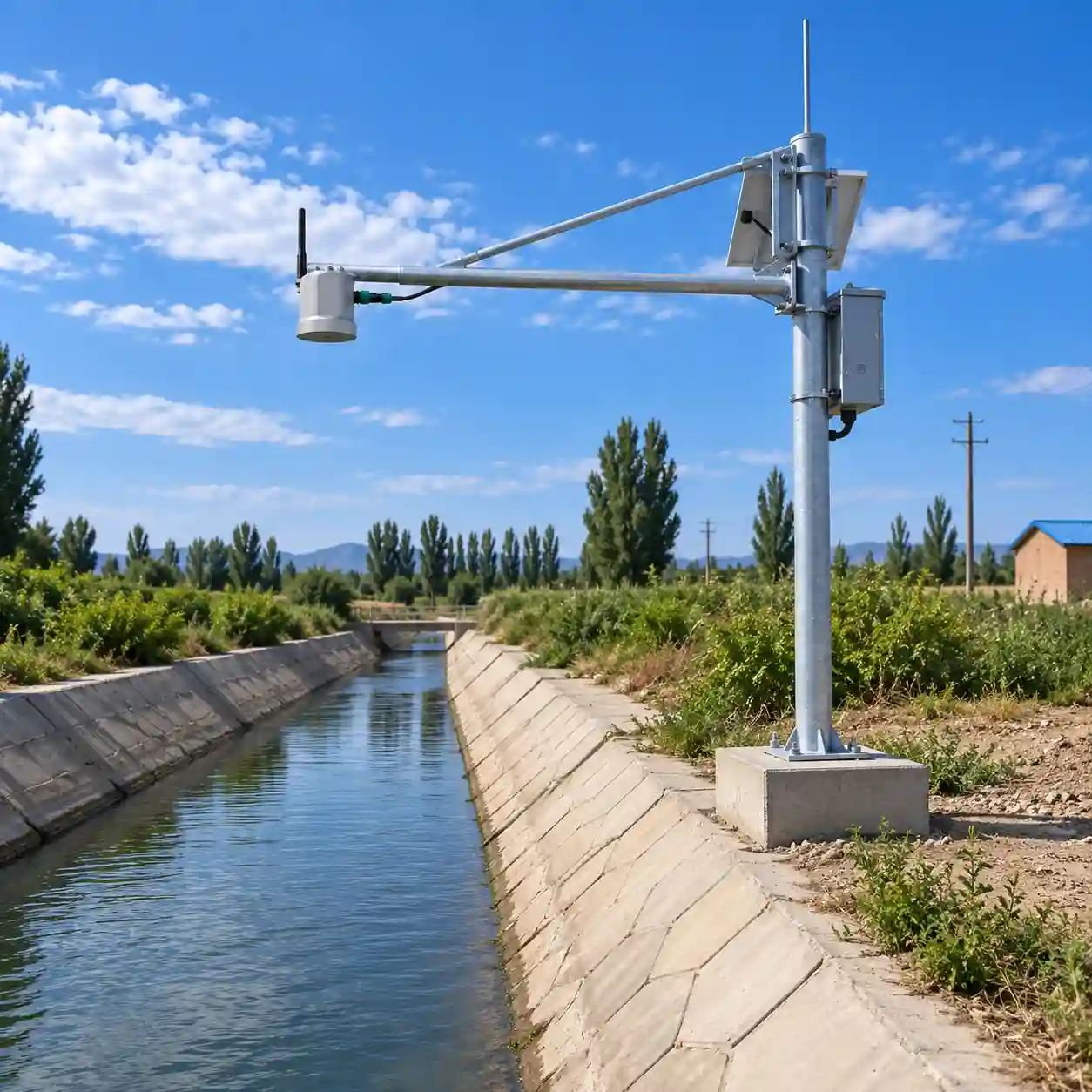
5.4 Irrigation Canal Water Level Monitoring
Irrigation networks may include open canals, gates, distribution structures, and drainage channels.
Radar water level measurement can support level observation and operational decision-making without requiring a sensor to remain submerged in canal water.
For irrigation projects where volumetric flow measurement is required, additional flow measurement technology or a validated hydraulic relationship is necessary.
5.5 Urban Flood and Drainage Level Monitoring
Urban monitoring applications include drainage channels, low-lying areas, and flood-prone underpasses where a suitable overhead mounting location is available.
Water level data can be transmitted to a monitoring platform and used with site-specific alarm thresholds.
Installation must account for mounting clearance, vehicle or pedestrian safety, possible flooding of the equipment, and local conditions.
6. Solar-Powered Remote Water Level Stations
Remote rivers and reservoirs may not have access to a continuous utility power supply.
The JW-RD-300 series supports a 7–32 VDC input and is designed for low-power monitoring applications.
A typical solar-powered station may include:
Radar water level sensor with the selected RTU configuration
Solar PV module
Battery
Charge controller and protection devices
Cellular or compatible wireless communication
Weatherproof mounting and electrical enclosure
Solar array and battery sizing should be based on actual device power consumption, communication activity, reporting interval, local solar resource, and required backup autonomy.
The sensor’s low-power design does not eliminate the need for a project-specific power budget.
7. Installation and Commissioning Guide
Correct sensor positioning is essential for reliable water level measurements.
Step 1: Select a Suitable Location
Choose a mounting point above the expected maximum water level and away from likely collision hazards.
Bridges, fixed poles, and suitable hydrological structures are common options.
Step 2: Evaluate the Radar Measuring Path
Make sure the radar beam has a clear view of the target water surface throughout the expected measurement range.
Consider bridge beams, channel walls, vegetation, and other obstructions.
The beam angle varies by radar configuration.
Step 3: Establish the Reference Datum
Determine the mounting elevation and reference level used by the hydrological monitoring system.
An incorrect reference height can create systematic errors in reported water levels.
Step 4: Configure Communication
Select the required wired or wireless interface.
For the RD-300-R, configure the server address, supported protocol, network parameters, and data upload interval.
Step 5: Verify Measurements
Compare the radar reading with an appropriate independent water level reference during commissioning.
Verify signal stability and review measurements under representative operating conditions.
Step 6: Inspect and Maintain
Periodically check mounting stability, antenna cleanliness, cable condition, power supply status, and remote data transmission.
The built-in angle sensing function can assist with installation attitude checks but does not replace physical inspection.
8. Radar Water Level Gauge vs Integrated Radar Flow Meter
JW-IoT provides different radar instruments for water level monitoring and open-channel flow measurement.
Feature
RD-300 / RD-300-R
RD-600 / RD-600-R
Main Function
Water Level Measurement
Flow Monitoring
Radar Water Level
Yes
Yes
Surface Velocity Measurement
Not Specified
Yes
Calculated Flow Rate
Not Specified
Yes
Integrated RTU Version
RD-300-R
RD-600-R
Typical Application
River Stage and Reservoir Level
River and Open-Channel Discharge Monitoring
Main Selection Factor
Water Level Monitoring Requirements
Flow Velocity, Level, and Channel Geometry
Choose the RD-300 series when the project primarily requires non-contact water level measurements, hydrological stage records, and remote level transmission.
Choose the RD-600 series when the project requires radar surface velocity measurement and flow calculation in addition to water level.
Before ordering the integrated radar water level gauge, confirm:
Measurement range: Maximum distance between the installation point and the water surface.
Radar configuration: Required frequency, beam angle, and associated measurement range.
Data output: RS485, optional SDI-12, or 4–20 mA according to the project interface.
Telemetry: Existing external RTU or integrated RD-300-R.
Wireless network: Coverage and compatibility of 4G, NB-IoT, or LoRa at the installation location.
Monitoring platform: Required protocol, data structure, reporting interval, and server connectivity.
Site power: Available DC supply or solar power configuration.
Mounting conditions: Bridge, pole, bracket, or dedicated hydrological station structure.
These details help ensure that the selected hardware and communication configuration match the monitoring project.
10. Build Your Hydrological Monitoring Station with JW-IoT
JW-IoT provides radar water level sensing and remote monitoring equipment for river hydrology, reservoirs, irrigation infrastructure, and flood monitoring projects.
The JW-RD-300 series is particularly suitable for applications requiring non-contact water level monitoring and flexible integration with existing or new telemetry networks.
For project selection, please provide:
Installation site and water body type
Sensor mounting height and required measurement range
Our team can help evaluate the measurement and communication requirements for an appropriate hydrological monitoring configuration.
FAQ
Q
1. What is this radar water level sensor used for?
A
This radar water level sensor is used for non-contact water level monitoring in rivers, lakes, reservoirs, irrigation canals, urban flood areas, and mountain flash flood warning systems.
Q
2. Does the sensor need to touch the water surface?
A
No. The device uses FMCW radar technology to measure water level without touching the water surface, making it suitable for polluted water, high-flow rivers, and harsh outdoor environments.
Q
3. What communication interfaces does the sensor support?
A
The sensor supports RS485 by default, with optional RS232, SDI-12, Modbus, and 4 to 20 mA output. The integrated RTU version can also support 4G, NB-IoT, or LoRa wireless transmission.
Q
4. Can this sensor be used with a solar power system?
A
Yes. The low-power design allows the radar water level sensor to work with solar-powered monitoring stations, making it suitable for remote outdoor sites.
Q
5. Does JW-IoT provide a radar water level solution for flood warning projects?
A
Yes. JW-IoT can provide a complete radar water level monitoring solution for flood warning, including sensors, RTU data transmission, solar power supply, cloud platform integration, and alarm configuration.
Q
6. What is the measurement accuracy?
A
The sensor provides high-precision measurement with accuracy up to ±3 mm and ±0.05% FS, and a resolution of 1 mm.
Q
7. Can it be installed outdoors for long-term monitoring?
A
Yes. The sensor has an IP68 protection rating, lightning protection, waterproof design, and outdoor-ready housing materials, making it suitable for long-term field deployment.
Q
8. Does JW-IoT support cloud platform integration?
A
Yes. JW-IoT can support cloud platform integration through protocols such as MQTT, HTTP, SL651, SZY206, HJ212, and customized protocols depending on project requirements.
Q
9. Can parameters be configured on-site?
A
Yes. The sensor has built-in low-power Bluetooth, allowing users to configure parameters and perform field maintenance through a mobile app.
Q
10. Is the device suitable for flood season monitoring?
A
Yes. The radar water level meter is designed to monitor under high-flow conditions during flood seasons and can be used in flood warning and disaster prevention projects.
 +86 13520127780
 info@jingelway.com