+86 13520127780
 info@jingelway.com









How Cloud Movement Data Supports Short-Term Solar Power Forecasting
Release time: 2026-09-10
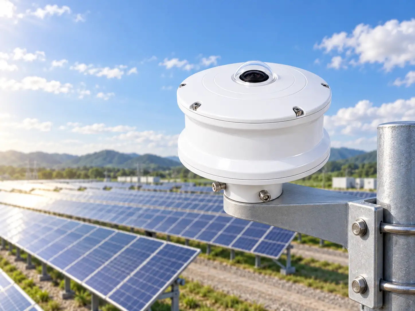
Cloud conditions are an important part of photovoltaic environmental monitoring because changes in cloud cover can influence the solar radiation reaching a PV site.
For short-term solar forecasting applications, it can therefore be useful to monitor not only the irradiance measured at the site, but also the cloud conditions visible around the monitoring location.
The JW-TK Series All-Sky Imager is designed for automated ground-based sky observation. According to the product documentation, it can capture full-sky images and provide cloud-related information for applications including cloud detection, cloud cover monitoring, cloud movement observation and solar power forecasting.
The accompanying product manual also states that the system is intended to provide site-level real-time sky data that can support photovoltaic power-generation forecasting.
This article explains how that type of sky information can complement conventional solar irradiance and PV monitoring data.
Why Cloud Conditions Matter in PV Monitoring
The JW-IoT product documentation states that cloud movement can cause rapid fluctuations in solar irradiance and photovoltaic power output.
This is why cloud conditions are relevant when analyzing short-term changes in PV generation.
A conventional solar monitoring station may already measure parameters such as:
- solar radiation,
- ambient temperature,
- relative humidity,
- wind speed,
- wind direction,
- rainfall,
- module temperature.
These measurements remain important because they provide direct numerical information about the environmental conditions at the monitoring site.
However, sky imaging provides a different type of information: visual and calculated information about the sky above the site.
That difference is important when the monitoring objective includes cloud behavior.
What Does an Irradiance Sensor Measure?
A solar radiation sensor measures irradiance at its monitoring location.
JW-IoT’s product documentation clearly distinguishes this from sky imaging: solar radiation sensors measure irradiance at the site, while an all-sky imager visually records cloud conditions that may affect irradiance.
In practical terms, the two devices provide different types of information.
Solar radiation sensor
provides:
measured solar irradiance at the monitoring point.
All-sky imaging system
provides:
sky images and cloud-related observation information.
Neither measurement replaces the other.
For PV monitoring projects, they can be used together when both irradiance and cloud information are required.
What Information Can Ground-Based Sky Imaging Provide?
According to the JW-IoT product page, the all-sky imaging system can provide or store information such as:
- original full-sky image,
- processed cloud-detection image,
- total cloud cover,
- clear-sky percentage,
- cloud-covered percentage,
- cloud distribution,
- cloud position,
- solar position,
- equipment operating status,
- historical image records,
- historical cloud-cover trends,
- image sequences for cloud-movement observation.
The product manual additionally lists cloud speed and cloud direction among the available data outputs.
These outputs provide information that is different from conventional point-based meteorological measurements.
Four Cloud-Related Variables That Matter for Monitoring
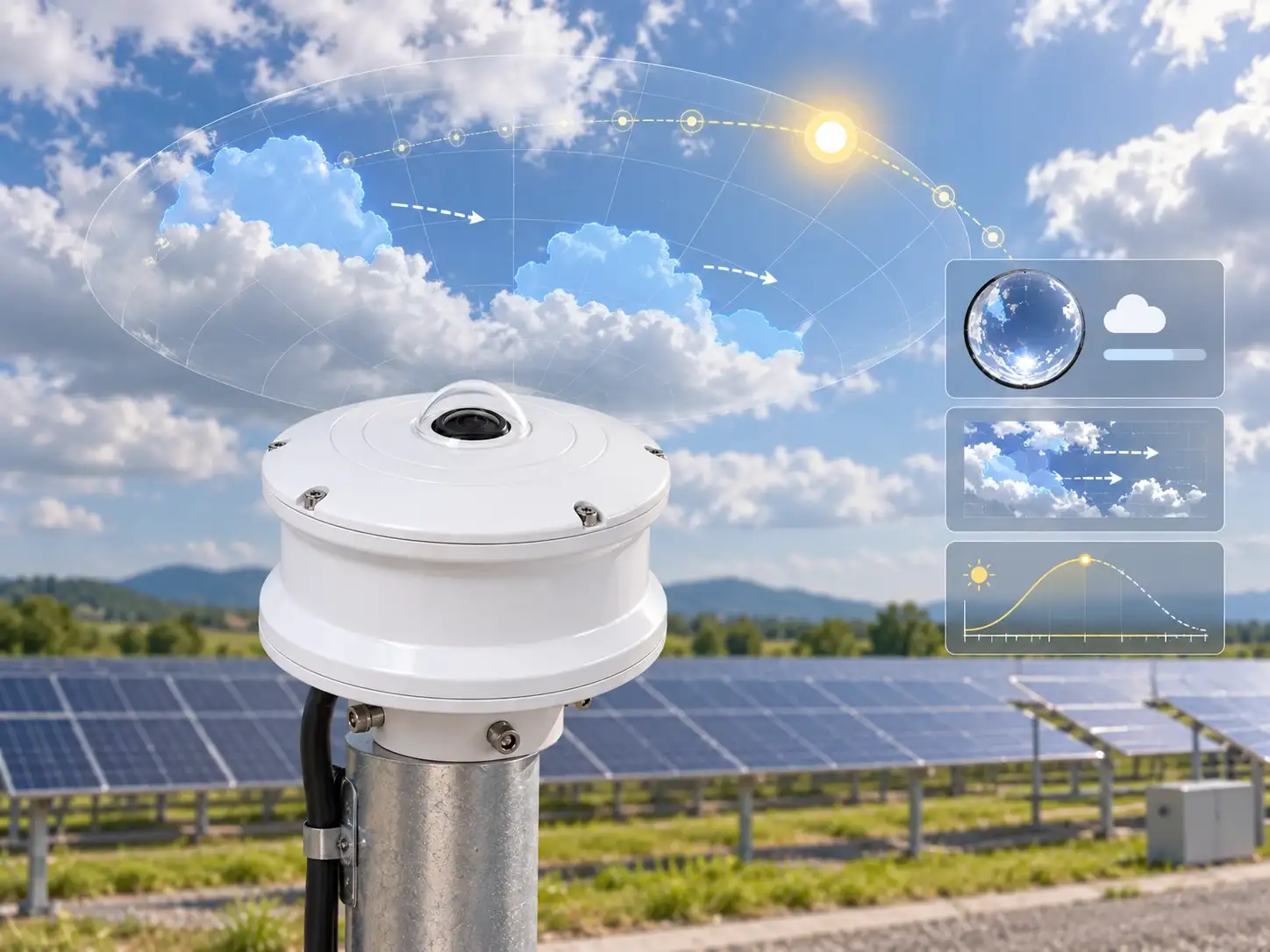
For PV environmental monitoring, several cloud-related variables can be particularly useful when interpreted together.
1. Cloud Cover
Cloud cover describes how much of the visible sky is occupied by cloud.
The JW-TK system can provide real-time cloud-cover information as part of its data output.
This helps provide a numerical description of current sky conditions.
Cloud cover should still be interpreted together with other information, because the same total percentage does not describe where clouds are located within the sky image.
2. Cloud Distribution
The product page includes cloud distribution among the available monitoring results.
This adds spatial context to cloud-cover data.
Instead of only describing the amount of cloud, sky imagery can also show how clouds are distributed across the visible sky hemisphere.
That information can be useful when comparing cloud conditions with measured irradiance.
3. Cloud Direction
The JW-TK manual lists cloud direction as an output parameter.
Cloud direction provides additional information about how local sky conditions are changing over time.
It should not be interpreted as a guaranteed forecast of future PV output on its own.
Rather, it is one of several cloud-related variables that can be used in a broader monitoring or forecasting system.
4. Cloud Speed
Cloud speed is also listed as an output parameter in the JW-TK manual.
When combined with repeated sky images and cloud-direction information, cloud-speed data can help describe changes in local cloud conditions.
The manufacturer documentation does not specify a guaranteed power-forecast accuracy or forecast lead time, so those values should be evaluated at project level rather than assumed from the imaging system alone.
How Sky Images Are Converted Into Cloud Information
The JW-IoT product page describes the monitoring workflow in several stages.
First, the hemispheric lens captures a wide view of the sky at a configured interval.
The system then processes the image and identifies valid sky areas. Depending on configuration, processing can include horizon masking, image correction, brightness adjustment, solar-area treatment, obstruction exclusion and cloud/clear-sky segmentation.
The resulting information can include cloud-cover values and processed cloud-distribution images.
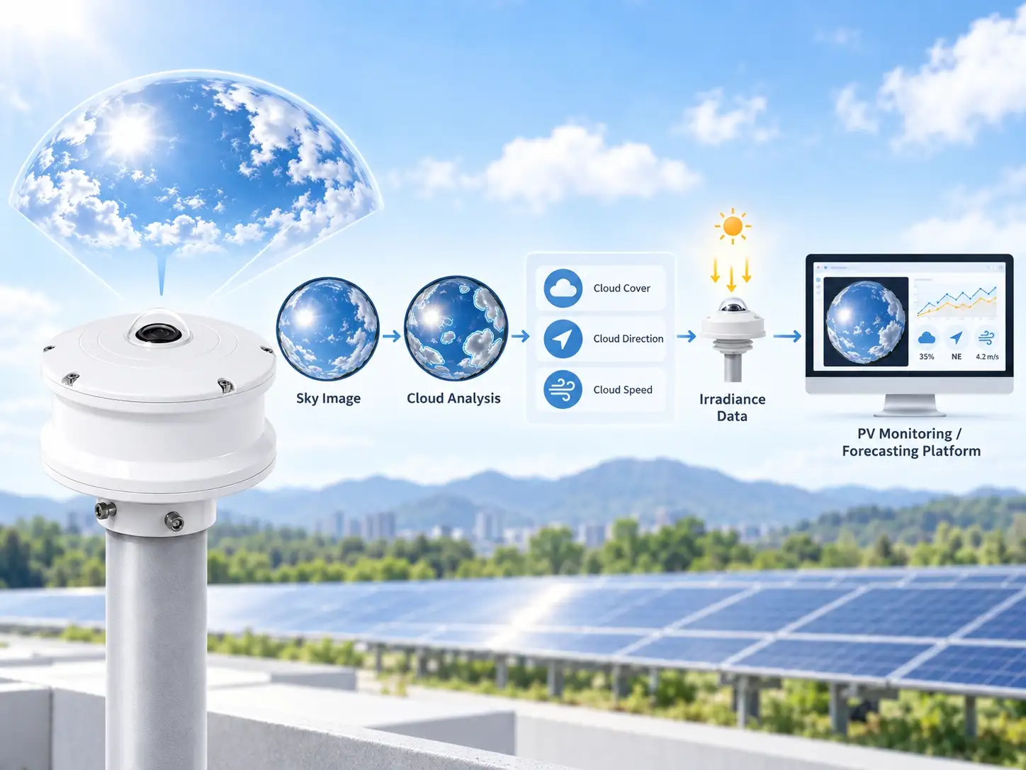
Through this process, sky images can be transformed into structured cloud-related information that can be combined with other PV monitoring data.
A simplified data flow is therefore:
Full-Sky Image
↓
Image Processing
↓
Cloud / Clear-Sky Identification
↓
Cloud-Cover and Distribution Results
↓
Historical or Real-Time Monitoring
This allows a visual sky image to become structured monitoring information rather than remaining only a photograph.
Why Combine Sky Images With Irradiance Data?
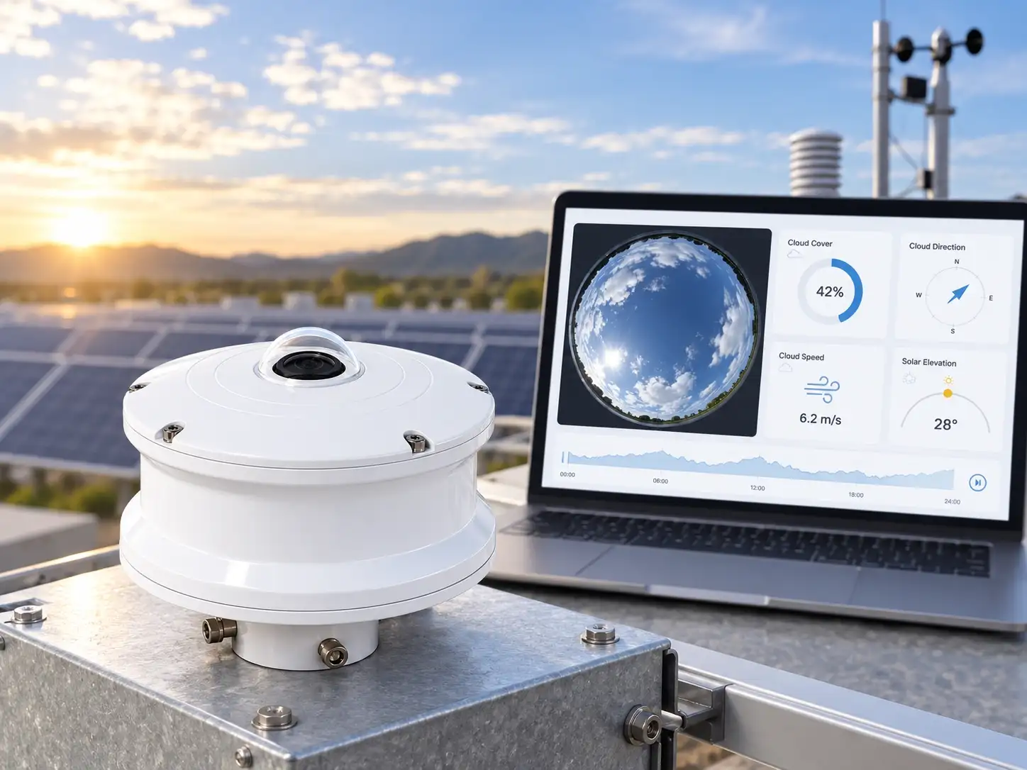
The product documentation specifically states that sky images can be combined with irradiance sensors, module-temperature sensors and PV power data.
That combination can provide different layers of information.
Sky image
Provides information about:
- cloud condition,
- cloud distribution,
- cloud movement,
- solar position.
Irradiance sensor
Provides:
- measured solar radiation at the monitoring point.
Module temperature sensor
Provides:
- photovoltaic module temperature.
PV power data
Provides:
- electrical generation information from the PV system.
When these datasets are compared using consistent timestamps, operators or forecasting systems can analyze the relationship between environmental conditions and PV performance.
The product documentation lists short-term solar forecasting, PV output fluctuation studies, solar resource analysis and plant performance evaluation among the possible applications of combining these datasets.
A Practical Data Relationship
For a PV monitoring project, the information relationship can be summarized as:
Cloud conditions
↓
Solar irradiance
↓
PV system response
An all-sky imager contributes information to the first layer.
A pyranometer or other radiation sensor measures the second layer.
PV plant data represents the third layer.
This structure can help engineers organize monitoring data without treating any single instrument as a complete forecasting solution.
All-Sky Imaging and Satellite Cloud Images Serve Different Roles
JW-IoT’s product page also distinguishes between ground-based all-sky images and satellite cloud imagery.
Ground-based sky imaging can provide:
- local sky observations,
- high-frequency images,
- records of small-scale cloud changes,
- synchronization with local irradiance and weather data.
Satellite imagery provides:
- wider geographic coverage,
- regional cloud information,
- broader cloud-movement context.
The product documentation therefore presents the two data sources as complementary.
For site-level PV monitoring, ground-based imaging provides local observations that can be compared directly with on-site sensor measurements.
Why Time Synchronization Is Important
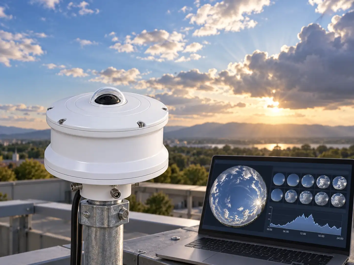
When sky images are compared with solar irradiance or PV power data, time alignment is essential.
The JW-IoT product documentation specifically states that accurate timestamps are important when sky images are compared with:
- solar irradiance data,
- PV power output,
- weather-station data,
- satellite images,
- numerical forecasting models,
- multiple monitoring stations.
Without aligned timestamps, it becomes more difficult to determine which sky image corresponds to a specific irradiance or PV-output value.
For system integrators, time synchronization should therefore be considered during project design.
How All-Sky Imaging Fits Into a PV Weather Monitoring System
An all-sky imager can be used as part of a wider solar environmental monitoring system.
The JW-IoT product page describes a typical integrated configuration that may include:
- 4K all-sky imager,
- solar radiation sensor,
- module temperature sensor,
- ambient temperature and humidity sensor,
- wind speed and direction sensor,
- rain gauge,
- data logger or industrial controller,
- Ethernet or 4G communication,
- local or cloud server,
- monitoring platform,
- API or database interface.
A simplified architecture can be shown as:
All-Sky Imager
→ Cloud information
Solar Radiation Sensor
→ Irradiance
Module Temperature Sensor
→ PV module temperature
Weather Sensors
→ Ambient environmental data
↓
Data Logger / Controller
↓
Local or Remote Monitoring Platform
For utility photovoltaic applications, see:
Solar Weather Monitoring Station for Utility Photovoltaic Power Plants
For irradiance monitoring equipment, see:
Photoelectric Total Solar Radiation Sensor for RS485 Irradiance Monitoring
JW-IoT Solar Radiation Sensors
What Can Affect Sky-Image Analysis?
The quality of sky-image analysis can be influenced by site and environmental conditions.
The product documentation lists factors including:
- direct sunlight,
- sunrise and sunset,
- thin cirrus clouds,
- haze,
- fog,
- dust,
- rain droplets on the optical dome,
- snow or frost,
- strong reflections,
- nearby obstructions,
- artificial lighting,
- nighttime conditions.
For this reason, sky-imaging equipment should be installed where the visible sky is as unobstructed as possible.
The product page recommends avoiding nearby structures such as tall buildings, trees, towers, chimneys, overhead cables and reflective surfaces because these can reduce the valid sky area or interfere with image processing.
These considerations are particularly important when the collected data will be used for forecasting or long-term environmental analysis.
One Monitoring Point or Multiple Points?
The number of sky-imaging locations should be determined according to the project rather than assumed in advance.
JW-IoT’s project-selection guidance asks customers to specify the number of monitoring points together with information such as application, site location, image interval, network availability and platform requirements.
The source documentation does not specify a universal coverage area for one imager.
Therefore, the required number of devices should be evaluated according to the actual project design and monitoring objective.
For large or distributed projects, this question should be confirmed during system configuration.
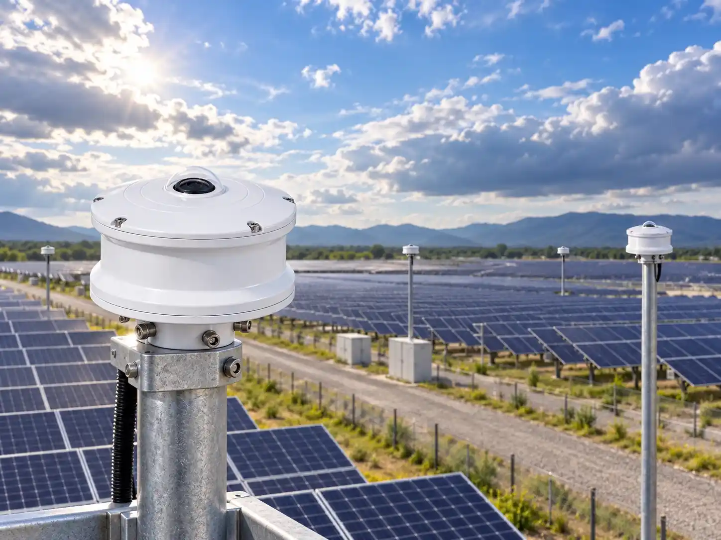
When Is All-Sky Imaging Relevant to a PV Project?
Based on the applications described in the JW-IoT documentation, all-sky imaging can be considered when a project requires:
- cloud-cover monitoring,
- cloud-distribution information,
- cloud-movement observation,
- site-level panoramic sky images,
- historical cloud-image records,
- integration with irradiance monitoring,
- short-term solar forecasting support,
- comparison between cloud conditions and PV power data.
The product documentation specifically lists solar PV power forecasting, weather-station integration, solar-radiation monitoring and meteorological observation among its applications.
Whether an all-sky imager is necessary should therefore depend on the monitoring objective rather than being treated as a standard requirement for every PV installation.
Example Product: JW-TK Series 4K All-Sky Imager
For projects requiring automated ground-based sky observation, JW-IoT provides the JW-TK Series 4K All-Sky Imager.
According to the product manual, the system combines optical imaging, image sensors and intelligent algorithms to capture all-sky images and analyze cloud conditions. It is intended to provide site-level sky data and support photovoltaic power-generation forecasting applications.
Detailed information about model configuration, technical specifications, communication methods and available project options is provided on the product page:
4K All-Sky Imager for Cloud Detection and Solar Forecasting
This blog intentionally does not repeat the full technical specification table because those engineering details are better maintained on the product page and latest project datasheet.
FAQ
1. What does an all-sky imager measure?
Depending on the selected configuration, it can provide full-sky images and cloud-related information such as cloud cover, cloud distribution, cloud position and historical image records. The JW-TK documentation also lists cloud direction and cloud speed among available outputs.
2. Does an all-sky imager replace a solar radiation sensor?
No.
The product documentation distinguishes the two instruments: solar radiation sensors measure irradiance, while the all-sky imager records cloud and sky information.
They can therefore be used together.
3. Can cloud images be used with PV power data?
Yes.
W-IoT’s product page states that sky images can be combined with irradiance sensors, module-temperature sensors and PV power data for applications including short-term forecasting and PV output fluctuation studies.
3. Does the system directly guarantee a specific forecasting accuracy?
The provided product documentation does not specify a guaranteed solar-power forecast accuracy, forecast lead time or cloud-arrival prediction accuracy.
These performance targets should therefore be confirmed separately according to the final forecasting system, software and project requirements.
4. Can ground-based sky images replace satellite cloud data?
No.
JW-IoT describes ground-based and satellite cloud imagery as serving different purposes and states that ground-based images can complement satellite information for local monitoring and solar forecasting.
5. How many all-sky imagers are required for one PV plant?
There is no universal number stated in the supplied product documentation.
The required number of monitoring points should be determined according to the project application, site and monitoring requirements.
Conclusion
Solar irradiance measurements and ground-based sky imaging provide different types of environmental information.
A solar radiation sensor measures the irradiance reaching the monitoring site.
An all-sky imaging system provides cloud and sky information, including cloud-cover, cloud-distribution and cloud-movement observations.
When these datasets are synchronized with PV plant information, they can support applications such as short-term solar forecasting, PV output fluctuation analysis and environmental monitoring.
The value of all-sky imaging therefore lies not in replacing conventional PV weather sensors, but in adding a cloud-observation layer to the monitoring system.
For projects where cloud behavior is relevant to PV monitoring or forecasting, this additional data source can be integrated with irradiance, module-temperature, weather and plant data according to the project’s technical requirements.
Explore JW-IoT Solar Monitoring Solutions
4K All-Sky Imager
4K All-Sky Imager for Cloud Detection and Solar Forecasting
Utility-Scale PV Weather Monitoring
Solar Weather Monitoring Station for Utility Photovoltaic Power Plants
Solar Radiation Sensor
Photoelectric Total Solar Radiation Sensor for RS485 Irradiance Monitoring
Radiation Sensor Category
JW-IoT Radiation Sensors
Product Center
JW-IoT Products
For project configuration, provide the application, installation location, required number of monitoring points, image interval, communication requirements, platform requirements and other site-specific information.