+86 13520127780
 info@jingelway.com









Why Regional Weather Forecasts Are Not Enough for Transmission Line Safety
Release time: 2026-09-17
Regional weather forecasts are essential for power-grid planning, but they cannot always describe the actual weather conditions experienced along a specific transmission corridor.
High-voltage transmission lines may extend across mountains, valleys, plains, river crossings, forest edges, coastal zones and other complex terrain. Weather conditions can vary significantly between these locations even when they lie within the same regional forecast area.
This is why transmission line microclimate monitoring is important for utilities, grid operators and engineering teams that need site-specific environmental data.
Local monitoring stations can measure the actual weather conditions occurring at or near important transmission-line sections, helping operators compare broad regional forecasts with real field conditions.
For complete corridor-level monitoring design, see:
High-Voltage Transmission Line Microclimate Monitoring Station
For integrated monitoring equipment and configurable weather parameters, see:
Transmission Line Weather Monitoring System for Power Grids
1. Regional Weather Forecasts Describe a Large Area
Regional forecasts are designed to represent weather conditions across a city, district or larger geographic area.
That is useful for general operational planning.
However, transmission lines often pass through terrain where localized weather conditions differ from the surrounding region.
Examples include:
- Mountain ridges
- Valleys
- River crossings
- Open plains
- Elevated terrain
- Forest boundaries
- Coastal corridors
- Remote rural areas
A forecast from the nearest city or regional meteorological station may therefore not fully represent the environmental conditions at a specific transmission tower or line section.
For infrastructure exposed continuously to local weather, this difference can matter.
2. Terrain Creates Transmission-Line Microclimates
A microclimate is a localized set of atmospheric conditions that differs from the broader weather pattern around it.
Transmission corridors frequently cross terrain that changes wind, temperature, humidity, rainfall and visibility.
For example:
- Valleys can channel wind
- Mountain ridges can experience stronger wind exposure
- Low-lying areas may retain moisture
- Coastal zones may experience different humidity and wind patterns
- Elevated sections may experience colder conditions than nearby lowlands
This means that one regional forecast may not describe conditions along the entire route.
Local monitoring provides direct measurements from selected points along the corridor.
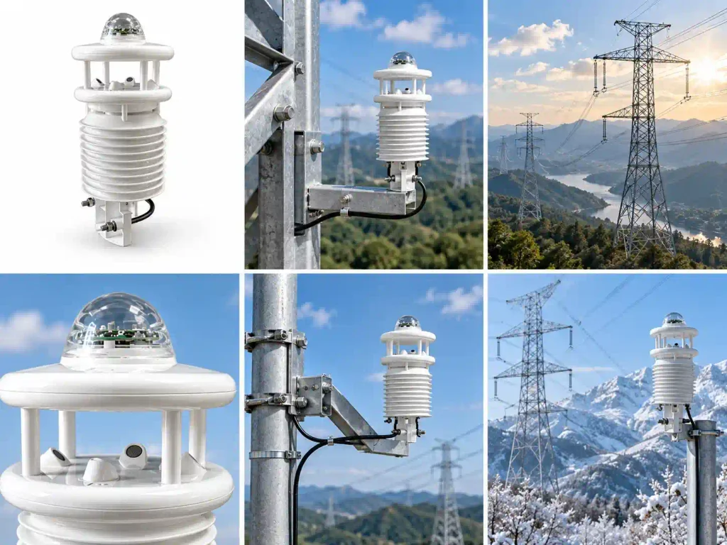
3. Why Local Wind Monitoring Matters
Wind is one of the most important weather factors affecting overhead transmission infrastructure.
Regional forecasts can provide general wind speed and direction, but local topography may significantly alter airflow.
Transmission corridors crossing:
- Mountain passes
- Valleys
- Open plains
- River corridors
- Exposed ridges
may experience different wind conditions from those reported at a distant weather station.
Local monitoring can provide site-level measurements of:
- Wind speed
- Wind direction
- Changes in wind conditions over time
For projects where wind is a major monitoring parameter, JW-IoT also provides:
4. Strong Wind and Transmission Corridors
Strong wind can create additional environmental loading on transmission-line infrastructure.
Depending on terrain, line design and weather conditions, operators may need to monitor:
- High wind speed
- Rapid wind changes
- Cross-valley airflow
- Persistent strong-wind zones
- Directional wind exposure
In some environments, conductor movement and galloping risk may also become engineering concerns.
A weather monitoring station does not replace mechanical or structural analysis, but it can provide the environmental data needed to understand the actual wind conditions surrounding the line.
5. Temperature, Humidity and Icing-Related Conditions
Transmission-line icing is another reason local weather data may be valuable.
Icing conditions are influenced by combinations of environmental factors rather than temperature alone.
Relevant parameters can include:
- Air temperature
- Relative humidity
- Dew point
- Wind
- Precipitation-related conditions
Localized terrain may create areas where low temperature and high moisture occur more frequently than broader forecasts suggest.
This can be especially relevant in:
- Mountain regions
- High-altitude corridors
- Cold climates
- Valleys
- Areas exposed to freezing weather
A local monitoring system can help observe the environmental conditions associated with icing risk.
It should not be treated as a substitute for a complete icing model, dedicated icing sensor or engineering risk assessment.
6. Why Local Rainfall Monitoring Matters
Rainfall can vary significantly over short distances.
For transmission-line infrastructure, rainfall information may be relevant not only to conductors and towers but also to surrounding terrain.
Potential concerns can include:
- Surface runoff
- Soil saturation
- Tower-foundation erosion
- Slope instability
- Landslide-prone areas
- Flood-prone corridors
This is especially important for transmission lines crossing mountainous or unstable terrain.
Local rainfall monitoring can provide site-specific data that complements regional precipitation forecasts.
7. Mountain and Cross-Valley Transmission Lines Need More Local Data
Mountain transmission corridors can be particularly difficult to monitor using only regional forecasts.
Elevation and terrain can create substantial variation over relatively short distances.
Different sections of one transmission line may experience different:
- Wind speeds
- Wind directions
- Temperatures
- Humidity levels
- Rainfall conditions
Cross-valley transmission sections can also be exposed to localized airflow patterns.
For these environments, selected monitoring points can provide a clearer picture of spatial weather variation along the corridor.
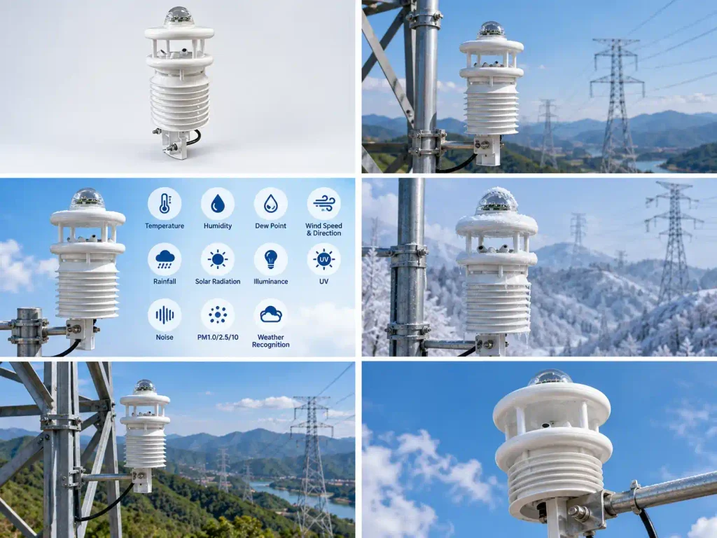
8. What Weather and Environmental Parameters Can Be Monitored?
The required parameters depend on the environmental risks and monitoring objectives of each project.
Core meteorological parameters may include:
- Air temperature
- Relative humidity
- Dew point
- Wind speed
- Wind direction
- Rainfall
- Solar radiation
Depending on project requirements and selected system configuration, additional environmental parameters may include:
- Illuminance
- UV radiation
- Noise
- PM1.0
- PM2.5
- PM10
- Weather-phenomenon recognition
Not every transmission-line project needs every available parameter.
A strong-wind corridor may primarily require:
wind speed + wind direction
An icing-related monitoring site may prioritize:
temperature + humidity + dew point + wind + precipitation-related information
A heavy-rainfall corridor may focus more on:
rainfall + temperature + humidity
A broader environmental monitoring project may add:
particulate matter + noise + radiation + weather recognition
For an integrated system covering multiple parameters, see:
Transmission Line Weather Monitoring System for Power Grids
9. Weather-Phenomenon Recognition Can Add More Local Context
Conventional weather sensors provide numerical measurements such as temperature, humidity, wind and rainfall.
Depending on system configuration, transmission-line monitoring systems may also support weather-phenomenon recognition.
This can add another layer of local environmental information where projects require more detailed observation of changing weather conditions.
The exact recognition capability depends on the selected system configuration and should be confirmed before project deployment.
Weather recognition should be considered as a supplement to measured meteorological data rather than a replacement for standard sensors.
10. Regional Forecasts and Local Monitoring Serve Different Purposes
Local weather monitoring should not be viewed as a replacement for regional forecasting.
The two provide different types of information.
Regional forecasts provide:
- Broad weather trends
- Expected weather development
- Regional planning information
Local transmission-line monitoring provides:
- Direct measurements at selected corridor locations
- Site-specific weather conditions
- Historical field data
- Comparison between locations
A useful monitoring concept is therefore:
Regional Forecast
↓
Expected Weather Conditions
plus
Local Microclimate Monitoring
↓
Actual Conditions at the Transmission Corridor
Together, these data sources provide a more complete environmental picture.
11. Why Continuous Monitoring Matters
Transmission lines often cross remote areas where manual weather observation is impractical.
Automatic monitoring allows environmental data to be collected continuously over long periods.
This can help teams observe:
- Daily weather variation
- Seasonal changes
- Strong-wind events
- Rainfall events
- Temperature and humidity changes
- Local microclimate patterns
Long-term field data can also help engineers compare how different sections of a transmission corridor respond to changing weather conditions.
12. Remote Data Acquisition and Platform Integration
Transmission-line weather stations are often installed far from offices or substations.
For this reason, field sensors typically need to work with a data-acquisition and communication system.
A typical architecture may be:
Weather and Environmental Sensors
↓
Data Acquisition / Monitoring Controller
↓
Remote Communication
↓
Monitoring Platform
The final communication method should be selected according to:
- Site coverage
- Power availability
- Monitoring distance
- Number of monitoring points
- Data transmission requirements
- Existing utility infrastructure
Depending on the project architecture, remote systems may use technologies such as:
- 4G
- LoRaWAN
- NB-IoT
- Ethernet
- Other compatible communication methods
The exact communication configuration should be confirmed according to the selected monitoring system rather than assumed to be identical for every project.
13. Local Weather Data and Smart Grid Monitoring
Modern grid monitoring increasingly combines electrical and environmental information.
Local weather data can add context for:
- Remote infrastructure observation
- Weather-related risk assessment
- Maintenance planning
- Environmental condition tracking
- Engineering analysis
Transmission-line weather information can therefore become one layer within a broader smart-grid monitoring framework.
For a complete microclimate monitoring approach, see:
High-Voltage Transmission Line Microclimate Monitoring Station
14. Where Should Transmission-Line Weather Stations Be Installed?
Monitoring locations should be selected according to the environmental risks and terrain of the corridor.
Potential locations may include:
- Mountain ridges
- Valley crossings
- River crossings
- High-altitude sections
- Strong-wind corridors
- Cold or icing-prone areas
- Landslide-prone slopes
- Flood-prone sections
- Remote locations with limited nearby weather observations
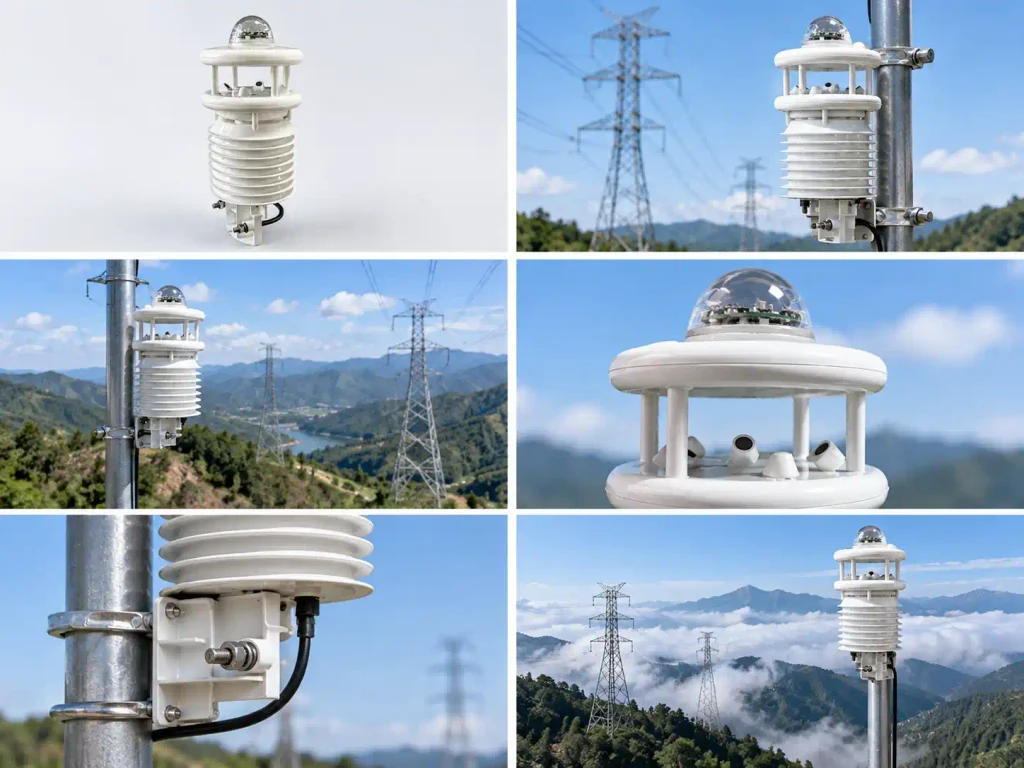
The objective is not necessarily to install as many stations as possible.
The objective is to place monitoring points where local environmental information is most valuable.
15. Why One Weather Station May Not Represent an Entire Corridor
A long transmission line may pass through several different climatic and geographic zones.
One monitoring station may not represent conditions across the whole route.
For example, a single corridor may pass through:
- Mountain + valley
- Forest + open plain
- River crossing + hillside
- Low altitude + high altitude
- Inland + coastal environment
In these cases, distributed monitoring can provide a better understanding of spatial weather variation.
The number and position of monitoring stations should be determined according to terrain, risk locations and project objectives.
16. How to Select a Transmission-Line Monitoring Configuration
Before selecting a monitoring system, define the project requirements first.
Transmission-Line Environment
Consider:
- Terrain
- Altitude
- Tower locations
- Valley crossings
- River crossings
- Vegetation
- Accessibility
Main Weather Risks
Identify whether the project is mainly concerned with:
- Strong wind
- Icing-related conditions
- Heavy rainfall
- High humidity
- Severe cold
- Low visibility
- Broader environmental monitoring
Monitoring Parameters
Determine which measurements are actually required.
Possible options include:
- Temperature
- Humidity
- Dew point
- Wind
- Rainfall
- Radiation
- Illuminance
- UV
- PM
- Noise
- Weather-phenomenon recognition
Data and Communication
Confirm:
- Number of monitoring points
- Sampling requirements
- Communication method
- Power supply
- Platform requirements
- Existing monitoring-system interfaces
This information allows the monitoring system to be configured around the real transmission corridor instead of using one identical package for every project.
FAQ
1. Why are regional weather forecasts not enough for transmission lines?
Regional forecasts represent relatively large geographic areas.
Transmission lines may cross mountains, valleys and other terrain where local wind, temperature, humidity or rainfall conditions differ from the regional average.
Local monitoring provides direct measurements from selected transmission-corridor locations.
2. What is transmission-line microclimate monitoring?
Transmission-line microclimate monitoring is the measurement of localized weather and environmental conditions near power transmission infrastructure.
Depending on project requirements, parameters may include temperature, humidity, wind, rainfall and other environmental measurements.
3. Why is local wind monitoring important?
Terrain can significantly change airflow.
A mountain ridge, valley or exposed crossing may experience wind conditions different from those measured at a distant weather station.
Local sensors provide site-specific wind data.
4. Can local monitoring help with icing-risk observation?
It can provide environmental measurements such as temperature, humidity, dew point, wind and precipitation-related conditions that may be relevant to icing risk.
However, a standard weather monitoring station does not replace a dedicated icing-measurement system or complete icing-risk model.
5. Why monitor rainfall near transmission infrastructure?
Rainfall can influence runoff, soil saturation, erosion and slope conditions.
For lines crossing mountainous, flood-prone or unstable terrain, local rainfall measurements can provide useful site-specific environmental information.
6. What parameters can a transmission-line weather monitoring system measure?
Depending on configuration, monitoring may include:
- Air temperature
- Relative humidity
- Dew point
- Wind speed
- Wind direction
- Rainfall
- Solar radiation
- Illuminance
- UV
- Noise
- PM1.0
- PM2.5
- PM10
- Weather-phenomenon recognition
The final configuration should be selected according to project requirements.
7. Do all transmission lines need the same sensors?
No.
The sensor package should reflect the terrain, weather risks and monitoring goals of the project.
A wind-risk corridor and an icing-risk corridor may require different parameter priorities.
8. Can monitoring data be transmitted remotely?
Yes.
Transmission-line monitoring systems can be designed with data acquisition, remote communication and platform integration.
The final communication method depends on the selected system configuration and field conditions.
9. Is weather-phenomenon recognition always included?
Not necessarily.
Weather-recognition capability depends on the selected system configuration and should be confirmed before ordering.
From Regional Weather to Corridor-Level Monitoring
Regional forecasts remain valuable for grid operations, but they cannot always represent the actual weather conditions at every transmission tower or corridor section.
For power lines crossing mountains, valleys, exposed terrain or remote areas, local microclimate monitoring can provide an additional layer of field information.
By combining regional forecasts with direct measurements of:
- Wind
- Temperature
- Humidity
- Dew point
- Rainfall
- Radiation
- Other project-specific environmental parameters
grid operators and engineering teams can develop a clearer understanding of weather conditions along the transmission corridor.
For complete corridor-level monitoring strategy and deployment:
High-Voltage Transmission Line Microclimate Monitoring Station
For the integrated monitoring equipment and available parameter configuration:
Transmission Line Weather Monitoring System for Power Grids
JW-IoT can support transmission-line projects with sensor selection, data acquisition, remote communication and project-specific monitoring-system configuration.